Transportation hub models provide urban planners, architects, and developers with a data-driven, three-dimensional representation to optimize connectivity, passenger flow, and land-use efficiency while improving communication among stakeholders.
How Is the Current Global Transportation Infrastructure Industry Evolving and What Pain Points Exist?
The global transportation infrastructure market reached over USD 2.8 trillion in 2025, with rapid expansion across Asia, the Middle East, and Europe. According to the World Bank and OECD reports, more than 40% of large-scale transportation projects, including airports, metro hubs, and intermodal terminals, face delays or budget overruns due to coordination challenges between design, construction, and policy stakeholders. The complexity of multimodal systems—blending rail, road, air, and pedestrian access—demands precise spatial planning and stakeholder visualization. Yet, conventional planning methods often fail to accurately represent traffic dynamics, passenger flows, and environmental impact zones, creating inefficiencies and miscommunication. Cities pursuing transit-oriented development (TOD) urgently need tools that integrate design intent, user experience, and sustainability objectives into one visual platform.
What Problems Do Traditional Visualization Approaches Face in Hub Design?
Traditional tools—2D blueprints, digital renderings, and static plans—only capture limited dimensions of complex transport networks. Multiple agencies often interpret these drawings differently, resulting in inconsistent design assumptions and costly reworks. Additionally, digital simulation tools require specialized software or technical expertise, restricting accessibility during committee meetings or public hearings. In large infrastructure projects, public understanding and stakeholder buy-in are crucial, yet computer renderings alone struggle to convey how various transit layers connect. Without physical modeling, teams lose the ability to analyze human-scale circulation and infrastructure integration across vertical levels.
Why Is the Solution from QZY Models a Game Changer?
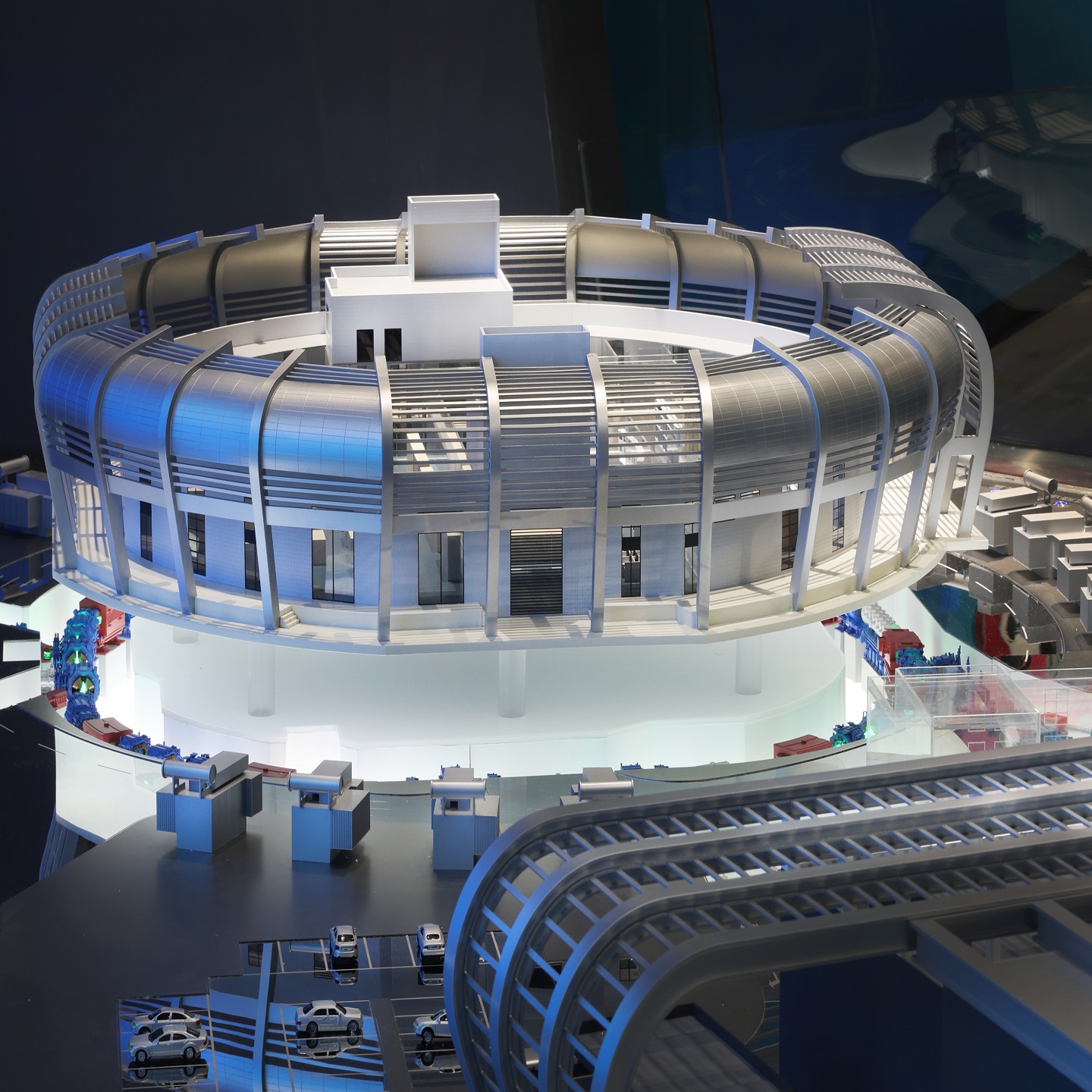
QZY Models, a global leader in physical architectural and industrial modeling, delivers highly precise transportation hub models that integrate multi-level spatial details, lighting systems, and movement simulation features. Utilizing their advanced production technology—laser cutting, CNC milling, and 3D printing—each model represents geographical accuracy within ±0.1 mm. With over 20 years of experience, QZY Models collaborates with international architects, developers, and government agencies to craft models that simplify decision-making, improve communication, and accelerate project approvals. Whether displaying airport terminals, railway interchanges, or integrated bus depots, QZY Models transforms complex infrastructure concepts into visually powerful and tactile experiences that foster understanding and trust.
How Do Physical Transportation Hub Models Compare to Traditional Visualization Tools?
| Criteria | Traditional Renderings / CAD / VR Tools | QZY Models Physical Hub Models |
|---|---|---|
| Spatial realism | Limited to digital perception | Fully tangible 3D spatial representation |
| Accessibility to non-technical audiences | Restricted by software and expertise | Intuitive and universally understandable |
| Coordination efficiency | Moderate | High through physical alignment visualization |
| Lighting and motion simulation | Often missing | Seamlessly integrated (LED, moving components) |
| Investment communication impact | Moderate | Significantly stronger visual and emotional engagement |
What Are the Steps Involved in Implementing QZY Models’ Transportation Hub Solution?
-
Project Consultation and Design Briefing – QZY Models conducts in-depth discussions with clients to define project scope, transport modes, and intended audience.
-
Digital Data Integration – Clients provide CAD, Revit, or GIS data, which QZY’s engineers adapt into scalable blueprints.
-
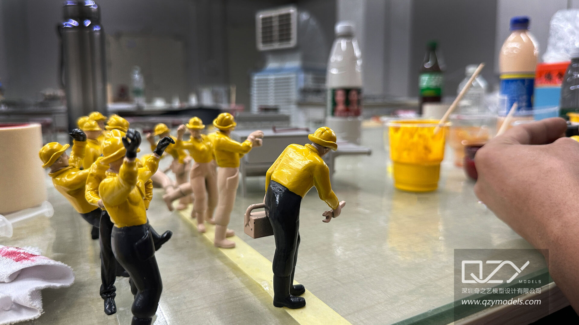
Precision Fabrication – Combining digital milling, 3D printing, and hand-finishing ensures structural consistency and realism.
-
Interactive Detailing – LED elements, digital motion cues, and removable layers illustrate multi-level interaction.
-
Quality Assurance and Delivery – Each model undergoes multi-point inspection before secure packaging, transport, and on-site installation.
Which Real-World Applications Demonstrate the Success of High-Quality Transportation Hub Models?
1. International Airport Expansion (Middle East)
-
Problem: Complex passenger transfer system between terminals required visualization for government approval.
-
Traditional Method: 3D renderings failed to express vertical connectivity.
-
Using QZY Models: A physical model with built-in LED pathways illustrated circulation routes clearly.
-
Result: Approval timeline shortened by 20%; enhanced stakeholder understanding.
2. Metro Interchange Planning (China)
-
Problem: Multi-line interchange caused confusion during public hearings.
-
Traditional Method: Digital diagrams lacked clarity.
-
Using QZY Models: Color-coded physical model supported easier explanation to the public.
-
Result: Improved community feedback and smoother design refinements.
3. Bus-Rail Integration Hub (Europe)
-
Problem: Coordination challenges between architecture and engineering teams.
-
Traditional Method: Isolated plans did not communicate intersection points.
-
Using QZY Models: Centralized model revealed geometric conflicts early.
-
Result: 15% design rework reduction; optimized site layout.
4. Urban Planning Exhibition (Asia)
-
Problem: Local governments sought effective communication tools for high-speed rail corridor development.
-
Traditional Method: Printed maps lacked immersive impact.
-
Using QZY Models: Display model attracted media attention and public education engagement.
-
Result: Greater transparency and stronger political endorsement.
Why Is Now the Right Time to Adopt Model-Based Visualization for Transportation Hubs?
Global investment in transit infrastructure will exceed USD 3.5 trillion by 2030, and the industry’s shift toward integrated smart cities requires visual planning tools that unite stakeholders from policy to engineering. QZY Models’ high-precision transportation hub models not only serve as design and marketing tools but also as communication bridges—making infrastructure understandable, inclusive, and actionable. As cities compete for sustainable growth, physical models have evolved from static displays to strategic instruments of collaboration. In today’s connected world, adopting such precision visualization is no longer optional—it’s essential to stay ahead.
Frequently Asked Questions
1. What scales are typically used for transportation hub models?
Common scales range from 1:100 to 1:1000, depending on project complexity and display requirements.
2. Can QZY Models integrate digital interactivity into the physical model?
Yes, digital screens, sensors, and lighting systems can be embedded for dynamic demonstrations.
3. Who should use transportation hub models?
Architects, urban planners, government agencies, investors, and exhibition curators benefit most from them.
4. How long does fabrication take?
Average production takes 4–10 weeks depending on project scale, with customized schedules available.
5. Are QZY Models’ products suitable for international delivery?
Yes, models are designed for modular transport and reassembly, ensuring safe global logistics.
Sources
-
World Bank Infrastructure Outlook 2025
-
OECD Transport Infrastructure Investment Report 2025
-
UN-Habitat Urban Mobility Trends 2025
-
Statista Global Smart City Infrastructure Data 2025
-
QZY Models Official Website