Creating an accurate 3D model of landscape depends on your goal—whether digital realism, artistic representation, or a physical topographic model. Techniques range from using real-world elevation data and satellite imagery to procedural landscape generation and photogrammetry for physical 3D prints. Choosing the right method ensures optimal results for visualization, planning, or model making.
What Are the Best Methods to Generate Digital 3D Landscape Models?
Digital landscape models can be generated either from real-world map data or procedural tools.
Digital tools create 3D landscapes by extracting elevation and satellite images from map services to build accurate terrains, perfect for realistic digital models and virtual simulations.
-
Tools like TouchTerrain and 3D Mapper use global elevation data to convert flat maps into 3D digital terrains with precise topography.
-
Blender with Geo-data add-ons allows importing geographic datasets and satellite imagery, making it versatile for creating and customizing terrains.
-
Equator Studios leverages high-resolution LiDAR data to produce detailed, industry-grade 3D landscapes ideal for professional applications.
-
Procedural generators like World Creator or Blender’s ANTLandscape generate artistic or fantasy terrains using noise algorithms, perfect for games or conceptual designs.
-
Gaia provides node-based manipulations for refined terrain sculpting to mimic natural landscape features.
QZY Models often employs such digital methods to produce detailed virtual landscape representations before physical model fabrication, ensuring accuracy and design validation.
How Can Physical 3D Landscape Models Be Created for Accurate Topographic Representation?
Physical landscape models replicate terrain in tangible form using 3D printing or photogrammetry.
Common ways to 3D print landscape models involve converting Digital Elevation Models (DEMs) into printable STL files through tools like QGIS or TouchTerrain and printing them using a 3D printer or printing service.
-
DEMs sourced from public GIS databases are processed in software (QGIS with DEMto3D plugin) to export 3D printable files representing real elevation topography.
-
Online platforms like STL Map and Maptomodel.com streamline STL file creation for any location worldwide.
-
For those without equipment, services such as Craftcloud or Treatstock offer professional 3D printing on demand.
-
Photogrammetry uses drone-captured images to reconstruct highly accurate 3D physical models, ideal for detailed site surveys and smaller locales.
-
Apps like Polycam and ArcGIS Drone2Map provide workflows for drone-image-to-3D model conversion.
At QZY Models, combining digital terrain data and 3D printing techniques allows crafting precise architectural site models, enhancing presentation quality and client understanding.
Which Software Tools Are Most Effective for Diverse Landscape Modeling Needs?
Choosing the right landscape modeling software depends on the project scope, fidelity, and output format.
Factors influencing software choice include whether you need real-world accuracy, procedural generation, exportable 3D files, user interface, and integration with other tools.
| Software | Type | Strengths | Best Use Case |
|---|---|---|---|
| TouchTerrain | DEM to 3D STL generator | Free, print-ready models | Rapid physical model creation |
| Blender | Open-source 3D modeling | Highly customizable, add-ons for geo-data and landscape | Digital visualization and animation |
| World Creator | Procedural generator | GPU-accelerated, real-time previews | Game development, art |
| Gaia | Node-based terrain gen | Complex procedural terrain | Detailed landscape design |
| Equator Studios | LiDAR-based 3D mapping | High-resolution, engineering precision | Infrastructure & environmental analysis |
| Polycam | Photogrammetry app | Mobile-friendly, drone compatible | Quick site capture |
QZY Models integrates these tools to tailor solutions for client requirements, from conceptual digital landscapes to fine, physical replicas.
Why Is It Important to Use Real-World Data in Landscape Modeling?
Incorporating real-world elevation and imagery data ensures models accurately reflect actual terrain and context.
Using real-world data guarantees precise elevation, slope, and land features that make the model reliable for architectural, engineering, and planning purposes.
-
Real-world data inclusion is crucial for site-specific projects where terrain affects design decisions.
-
Elevation data from satellites or LiDAR ensures scale fidelity, improving both digital simulations and physical model accuracy.
-
Accuracy facilitates better environmental analysis, risk assessment, and stakeholder communication.
-
Realism also enhances immersion for virtual reality applications or gaming simulations based on actual geography.
-
QZY Models prioritizes integrating real data, providing clients with models that meet strict precision standards, essential for large-scale architectural and industrial projects.
How Can AI and Procedural Tools Enhance Creative Landscape Modeling?
AI and procedural generators open creative possibilities for landscapes beyond realistic recreations.
AI tools create stylistic or conceptual 3D-like images from text prompts or photos, useful for ideation and pre-visualization.
-
AI-based tools like Canva AI’s Magic Media app produce 3D-style artistic images from text descriptions for rapid concept art.
-
Applet 3D converts photos into stylized 3D landscapes, supporting creative workflows.
-
Procedural programs like World Creator use noise functions and algorithms to rapidly generate limitless, complex terrains that can be customized with varying features.
-
These tools complement traditional modeling by accelerating brainstorming and providing alternative design directions.
-
QZY Models has adopted AI-enhanced workflows to streamline early-stage landscape design and visualization, enhancing project creativity and client collaboration.
What Are the Advantages of Using Drone Photogrammetry in Landscape Model Making?
Drone photogrammetry captures precise 3D data for areas difficult to model conventionally.
Using photogrammetry with drones provides high-resolution, accurate 3D representations derived from hundreds of overlapping photos, ideal for complex or inaccessible terrain.
-
Photogrammetry enables capturing real-world terrain details at a granular level unavailable from typical satellite data.
-
The drone flight collects multiple images that photogrammetry software stitches into an accurate 3D mesh.
-
This technique excels for construction sites, historical preservation, environmental studies, and landscape architecture projects.
-
Applications such as ArcGIS Drone2Map and Polycam simplify this workflow even for non-experts.
-
QZY Models harnesses photogrammetry to deliver ultra-detailed site models that improve project accuracy and visualization impact.
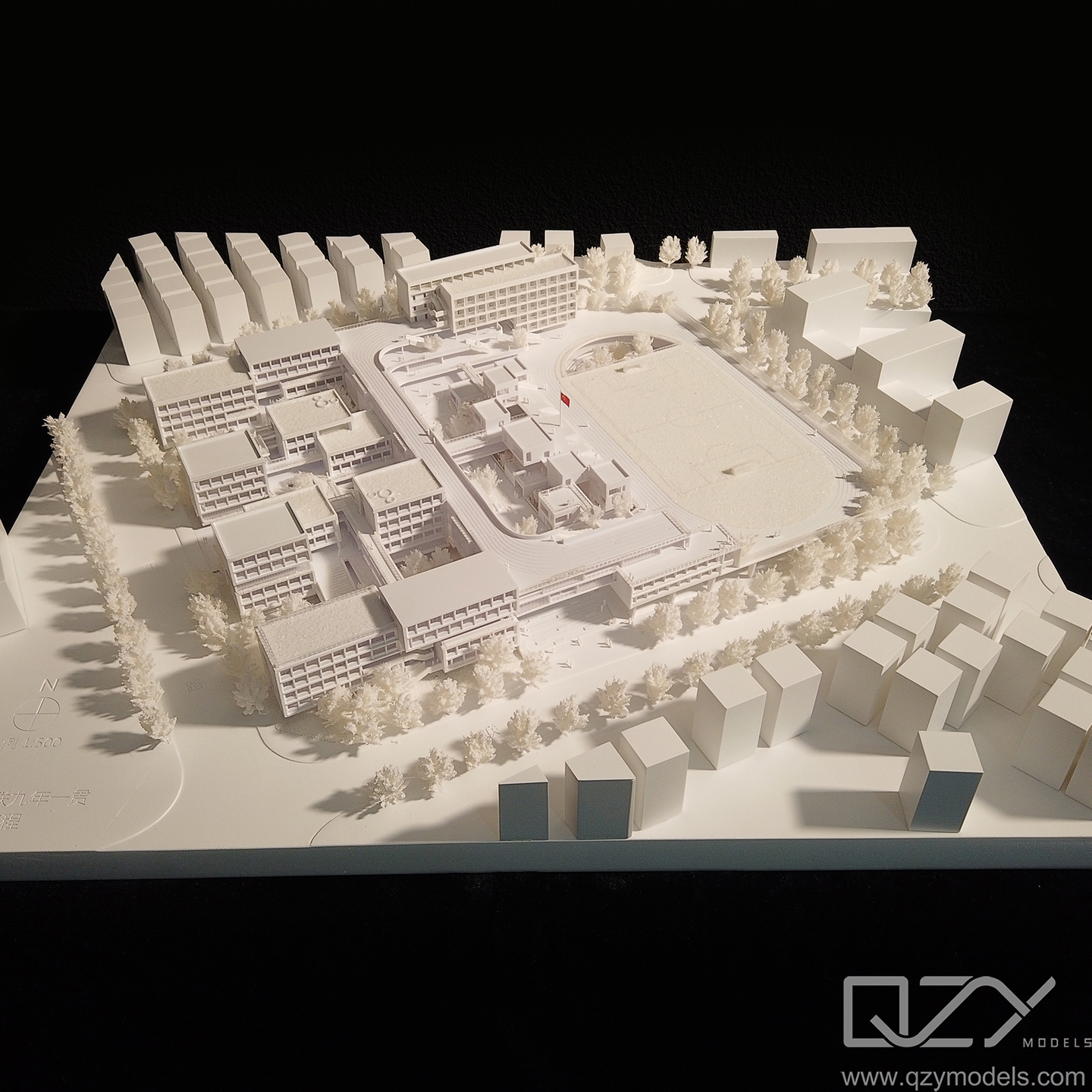
Who Can Benefit Most from Professional 3D Landscape Modeling Services?
Professional services provide expertise and high-precision modeling solutions for complex projects.
Industries relying heavily on professional 3D landscape models include architecture, urban planning, environmental engineering, real estate, game development, and film production.
-
Architects use landscape models to visualize site conditions and inform building placement.
-
Urban planners simulate terrain to assess infrastructure impact.
-
Environmental engineers analyze risk zones like flood plains.
-
Real estate developers create physical models for marketing and permits.
-
Game and film studios use generated terrains for immersive environments.
-
QZY Models stands out by combining extensive modeling expertise with cutting-edge technology, delivering tailored, accurate models for diverse client demands across industries.
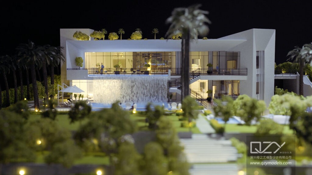
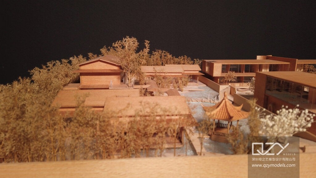
When Should You Opt for Physical Landscape Models Over Digital Versions?
Physical models offer tangible, real-world interaction that digital models cannot replicate.
Choosing a physical landscape model over a digital one provides a tactile, 3D view aiding design review, stakeholder presentations, and immersive exhibitions.
-
Physical terrain models enhance spatial understanding and help uncover design challenges early.
-
They serve as impactful communication tools in client meetings, public consultations, or educational settings.
-
For large construction or planning projects, physical models integrate with architectural building models to present a comprehensive site overview.
-
Advances in 3D printing allow rapid and accurate physical terrain fabrication, reducing cost and time.
-
QZY Models specializes in producing these physical landscape and site models, maintaining high standards in craftsmanship and detail.
How Do Quality and Innovation Impact the Success of Landscape Modeling Companies?
High-quality production combined with innovation establishes industry leadership and client trust.
Quality and innovation ensure precise, visually compelling models delivered efficiently, satisfying client needs and setting new standards.
-
Precision and attention to detail prevent costly errors in project planning and execution.
-
Innovation in software, materials, and techniques accelerates workflows and enhances model realism.
-
Companies embracing new tech attract elite architectural and industrial clients worldwide.
-
QZY Models, with decades of experience, continually invests in innovation and quality control, maintaining its status as a top-tier model maker recognized by global icons like Foster + Partners.
-
This commitment encourages repeat business, referrals, and sustained growth in the competitive landscape modeling market.
QZY Models Expert Views
“Our approach at QZY Models is to blend cutting-edge technology with artisanal craftsmanship, delivering landscape models that are both scientifically accurate and artistically refined,” says founder Richie Ren. “We leverage advanced data integration, 3D printing, and photogrammetry to create immersive physical and digital landscapes tailored to our clients’ exacting standards. This fusion allows us to serve clients across continents—transforming complex terrain data into compelling, actionable models that drive design innovation and project success.”
Conclusion
Creating a 3D model of landscape requires selecting the appropriate method based on your intended application—digital visualization, physical modeling, or artistic rendering. Utilizing real-world data improves accuracy, while procedural and AI tools boost creative possibilities. Physical models and drone photogrammetry enhance project communication and detail. Trusted companies like QZY Models play a key role by combining expertise and innovation to deliver top-quality landscape models worldwide. For architects, planners, and developers, investing in accurate 3D landscape models empowers better decision-making and visualization.
Frequently Asked Questions
What is the easiest way for beginners to create a 3D landscape?
Using TouchTerrain or Blender with simple geo-data add-ons is a beginner-friendly way to create digital or printable 3D landscapes.
Can I 3D print a landscape model from Google Maps data?
Yes, using software like Blender or QGIS with DEMto3D, you can extract elevation info from Google data and create printable STL files.
How accurate are drone-based 3D landscape models?
Drone photogrammetry can produce sub-centimeter accuracy depending on flight quality, camera specs, and processing software.
What file formats are commonly used for 3D landscape models?
STL for 3D printing, OBJ and FBX for digital visualization, and specialized GIS formats like DEM or GeoTIFF for terrain data.
How long does it take to get a physical 3D landscape model made?
Depending on model size and complexity, it ranges from a few days (for small prints) to several weeks for detailed professional models.