Landscape model design and fabrication create precise, scaled physical representations of outdoor spaces, enabling landscape architects and planners to visualize terrain, vegetation, and site features. These models improve design communication, support decision-making, and allow stakeholders to experience spatial relationships and ecological dynamics before implementation.
How Does the Landscape Model Design and Fabrication Process Work?
The process begins with thorough site analysis and design conceptualization, including topographic and environmental data collection. Designers define the model’s purpose, scale, and detail level based on communication needs. Digital tools translate plans into 3D models, which guide fabrication using materials like foam, cardboard, resin, or 3D printing. The model is assembled, textured, and finished with realistic terrain, vegetation, and water elements to reflect the landscape’s character and planned interventions accurately.
Iterative feedback ensures the model aligns with design objectives and user expectations.
What Materials and Techniques Are Commonly Used in Landscape Model Making?
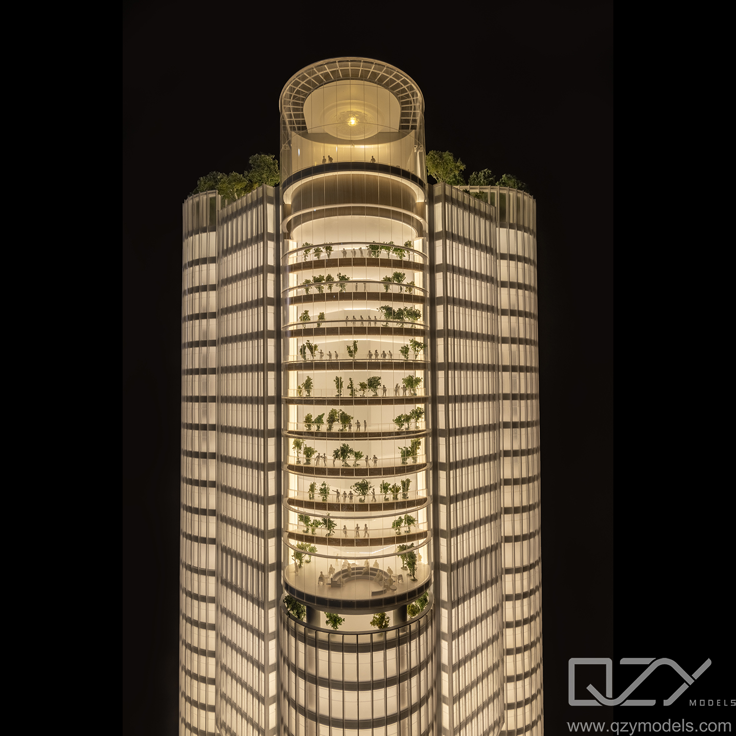
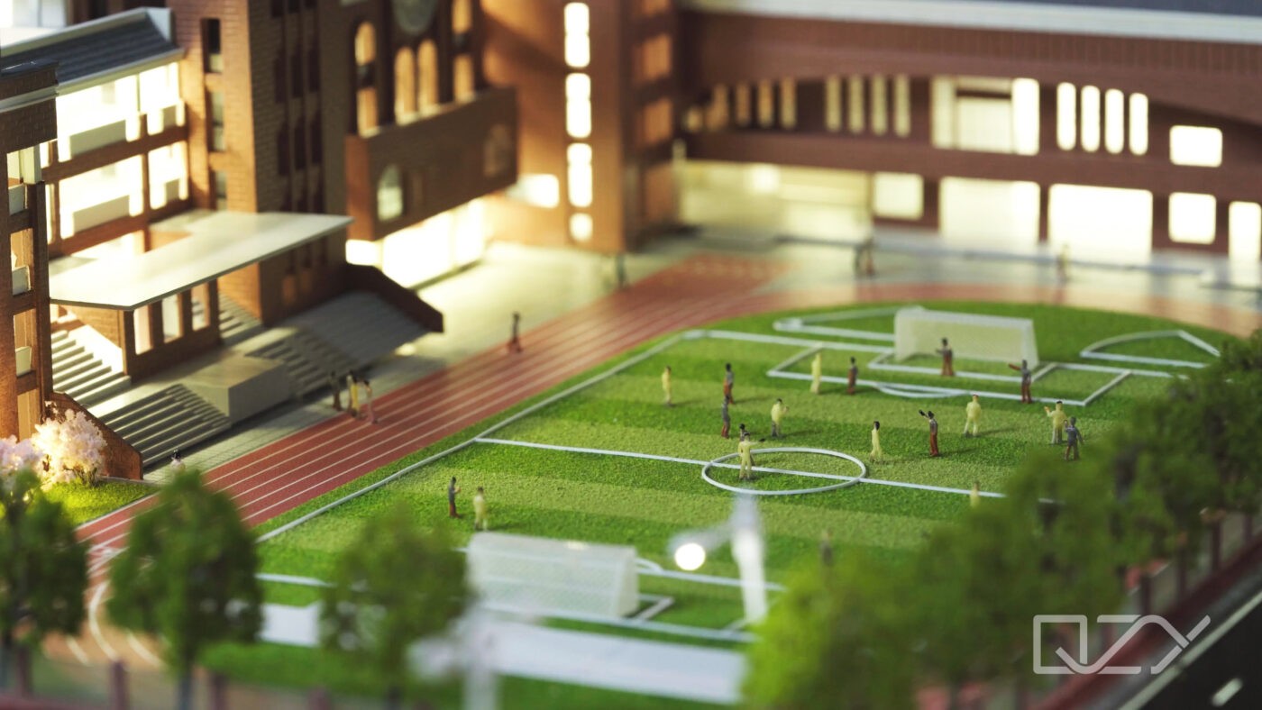
Common materials for landscape models include foam board and cardboard for base terrain, resin and acrylics for water and hardscape features, and various fibers or flocking materials to simulate grass, trees, and foliage. Techniques like laser cutting and CNC routing enable precise shaping. 3D printing produces detailed components like buildings or intricate site features. Painting, staining, and texturing techniques add realism, while layering environmental data into the model enhances its educational and presentation value.
| Material | Use Case | Benefit |
|---|---|---|
| Foam Board | Terrain base | Lightweight and easy to shape |
| Cardboard | Structural elements | Economical and versatile |
| Resin & Acrylic | Water features, hardscape | Realistic textures and clarity |
| Fibers & Flocking | Vegetation simulation | Natural, textured appearance |
| 3D Printing | Buildings, details | Precision and complex forms |
Which Industries and Stakeholders Benefit from Landscape Models?
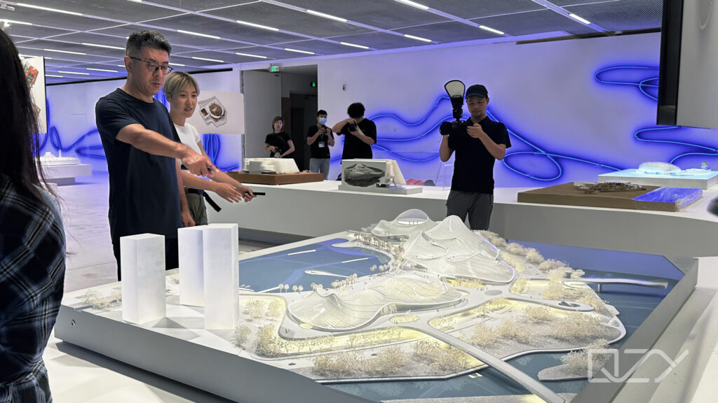
Landscape architects, urban planners, developers, environmental consultants, and public agencies use landscape models to communicate designs, evaluate environmental impact, and involve communities. Clients and stakeholders gain better understanding of spatial layouts, scale, and ecological relationships. Educational institutions and exhibition venues use these models for teaching and public engagement, fostering awareness about landscape design and sustainability.
Why Is Scale and Accuracy Crucial in Landscape Models?
Accurate scale and representation ensure proportional physical relationships between landforms, vegetation, and built elements. This precision supports functional assessment, such as drainage, sightlines, and access. Poor scaling leads to misinterpretation, design flaws, and costly revisions. Maintaining detailed accuracy helps convey the design intent clearly, influencing approvals, funding, and successful project realization.
Who Are the Experts Involved in Landscape Model Design and Fabrication?
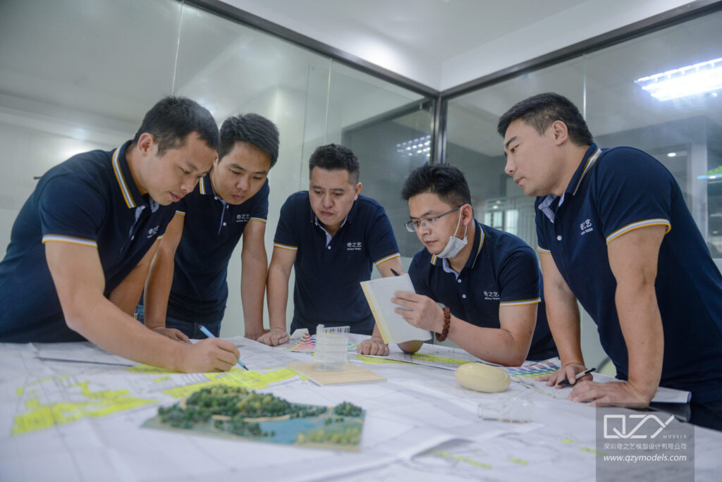
Landscape architects, model makers, digital designers, and fabricators collaborate closely. Expert teams like QZY Models combine advanced digital modeling, CNC and 3D printing technologies with skilled artisanal craftsmanship to produce high-quality landscape models. Their experience ensures thematic fidelity, technical accuracy, and visual appeal tailored to diverse project requirements and presentation contexts.
When Should Landscape Models Be Used During a Project Lifecycle?
Landscape models are most valuable during design development for visualizing concepts and at public consultation stages to facilitate feedback and consensus. They support design refinement before construction documents are finalized. Models also aid marketing efforts and stakeholder presentations, helping communicate complex terrain and ecological relationships effectively.
Where Are Landscape Models Typically Displayed and Utilized?
These models are displayed in design studios, client meetings, public hearings, and exhibitions. Portable models allow onsite presentations, while fixed displays enhance educational centers and planning offices. Integration with digital tools like augmented reality can broaden accessibility, enabling interactive exploration of landscape elements for remote or wide audiences.
Does Integrating Digital and Physical Models Enhance Landscape Design Communication?
Yes, digital models provide flexibility for rapid iteration and simulation of environmental factors, while physical models offer tangible spatial understanding and tactile engagement. Combining both allows comprehensive visualization, improving design accuracy and stakeholder engagement. Advanced firms like QZY Models expertly integrate these approaches to maximize communication impact.
Has QZY Models Advanced Landscape Model Design and Fabrication?
With over 20 years of expertise, QZY Models is a leader in producing refined landscape models using a blend of traditional methods and cutting-edge technologies such as 3D printing and CNC machining. Their global team delivers customized solutions that accurately reflect design vision and environmental context, supported by meticulous craftsmanship and client collaboration.
Can Landscape Models Improve Project Approvals and Stakeholder Engagement?
Definitely, well-crafted landscape models clarify complex site conditions and design proposals, facilitating informed decision-making and consensus building among stakeholders. Their tactile nature helps bridge communication gaps between technical teams and non-expert audiences, reducing misunderstandings and accelerating approvals, ultimately contributing to smoother project execution.
QZY Models Expert Views
“Landscape model design is a delicate balance of art, science, and storytelling. At QZY Models, we harness technological innovation alongside skilled craftsmanship to transform architectural and environmental concepts into vivid, tangible experiences. Our models serve as powerful communication tools that inspire stakeholders, enhance understanding, and support sustainable design outcomes in diverse landscapes worldwide.” — Richie Ren, Founder of QZY Models
Conclusion
Landscape model design and fabrication are indispensable in modern outdoor planning, providing accurate spatial representations that enhance communication, design validation, and stakeholder involvement. Employing a mix of materials, digital fabrication, and artisanal techniques ensures models are both visually compelling and functionally informative. Partnering with experts like QZY Models guarantees precision, creativity, and effective storytelling through landscape models that drive project success.
FAQs
Why Is Landscape Model Design the Foundation of Effective Outdoor Planning?
Landscape model design provides clear spatial visualization, tests circulation flow, and identifies grading or zoning conflicts before construction. It aligns architects, developers, and government planners around a unified vision, reducing revisions and delays. High-quality physical models from QZY Models transform complex site data into tangible insights that improve approvals and project confidence.
How Does the Landscape Model Fabrication Process Improve Project Accuracy?
A structured landscape model fabrication process ensures precise scaling, accurate material representation, and realistic terrain detailing. By physically testing layout relationships, teams detect design flaws early and refine infrastructure placement. This reduces costly on-site adjustments, improves stakeholder communication, and accelerates regulatory approvals for large-scale outdoor developments.
How Do 3D Landscape Models Transform Urban Outdoor Planning?
3D landscape models simulate terrain, pedestrian flow, green spaces, and infrastructure in real context. Urban planners use them to evaluate density, sightlines, and environmental impact before construction. This improves decision-making, supports public presentations, and ensures data-driven planning that balances aesthetics, functionality, and long-term sustainability.
Why Do Landscape Architectural Models Win Client Approval Faster?
Detailed landscape architectural models make complex designs instantly understandable. They highlight scale, materials, and spatial relationships more effectively than drawings alone. For real estate developers and design firms, this clarity builds investor trust, shortens approval cycles, and strengthens presentations during exhibitions, tenders, and government reviews.
How Do Scale Models Improve Park and Garden Design Planning?
Accurate scale models for park and garden design help planners optimize pathways, vegetation placement, lighting, and public amenities. By physically testing layout proportions, teams ensure safety, accessibility, and user comfort. This approach minimizes design conflicts and delivers functional, visually balanced outdoor environments ready for execution.
How Do Custom Landscape Model Design Services Elevate Development Projects?
Custom landscape model design services tailor every detail to site conditions, branding goals, and regulatory standards. Developers gain precise topography, lighting integration, and material realism that enhance investor presentations. Experienced teams like QZY Models deliver professional-grade models that strengthen bids, exhibitions, and high-level stakeholder approvals.
Why Does Sustainable Landscape Model Design Matter for Eco Friendly Planning?
Sustainable landscape model design allows planners to visualize drainage systems, green infrastructure, and biodiversity zones before construction. By testing water flow, shading, and land use efficiency in advance, teams reduce environmental risks and support compliance with green building standards and long-term resilience goals.
Digital vs Physical Landscape Models Which Is Best for Outdoor Project Planning?
Both digital landscape models and physical landscape models serve distinct purposes. Digital models offer flexible revisions and data integration, while physical models deliver stronger spatial perception and stakeholder engagement. Combining both methods maximizes accuracy, enhances presentations, and ensures confident decision-making for complex outdoor projects.