Urbanization is accelerating worldwide, and cities are under pressure to justify every square meter of land through clear, persuasive planning proposals. High-fidelity 3D park models help stakeholders understand spatial relationships, investment value, and user experience at a glance, turning abstract drawings into compelling, decision-ready visuals that drive approvals and funding.
How is the park planning and presentation landscape changing?
Global urban populations are expected to reach nearly 70% of the world’s population by 2050, putting unprecedented pressure on cities to provide high-quality public green spaces. At the same time, project approval cycles are becoming more complex, involving not only government departments but also investors, community groups, and cross-border partners. This makes clear, intuitive communication tools essential rather than optional. Under this context, physical park models and 3D visualization have evolved from “nice-to-have displays” into core tools for project persuasion, funding, and stakeholder alignment.
The rise of mixed-use developments means parks often sit at the intersection of residential, commercial, and transportation zones. A flat site plan rarely captures how height differences, landscape layers, lighting, and circulation actually work together on site. When decision-makers cannot intuitively understand how a park integrates with surrounding buildings, roads, and water systems, they tend to delay or downgrade projects. This leads to higher costs, missed windows for land use, and repeated redesigns.
Meanwhile, design teams are under pressure to demonstrate environmental, social, and economic impacts with evidence. They must show how green coverage, accessibility, and amenity distribution translate into real-world user experience. Without a tangible 3D park model that makes these metrics visible — such as shaded areas, view corridors, and activity hotspots — even strong data can fail to persuade non-technical audiences.
What are the main pain points in current park project presentations?
First, 2D drawings and basic 3D renders are hard for non-professionals to interpret. Residents, investors, and decision-makers may struggle to understand scale, height, and circulation paths from plans and elevations alone, leading to misinterpretation and resistance. This often surfaces during public consultations, where questions arise about noise, visibility, and access that could have been pre-emptively addressed with a physical model.
Second, standard digital presentations lack tactile and spatial presence. On-screen models depend on navigation skills, screen size, and device performance, which can limit engagement in public hearings or boardroom meetings. Without a shared, physical reference that everyone can stand around and discuss, it is harder to build consensus and align expectations.
Third, international and cross-cultural projects face added communication barriers. Colors, symbols, and drawing conventions vary between regions and organizations. A well-crafted 3D park model can act as a neutral, universal language, but many teams still rely solely on slide decks and PDFs. This gap often leads to repeated explanation cycles, prolonged negotiations, and expensive revisions after misunderstandings are discovered too late.
How do traditional solutions fall short in 3D park presentations?
Traditional presentations for park projects typically rely on a combination of CAD drawings, simple 3D renders, and static boards mounted in meeting rooms or exhibitions. While these tools are useful for technical coordination, they are not optimized for fast, intuitive understanding by non-experts. The result is a strong technical package but weak narrative power when it matters most — in front of decision-makers.
Even when teams invest in high-quality digital visualizations, such as animations or VR experiences, they can face logistical and technical challenges. Headsets, powerful laptops, and controlled environments are not always available in government meetings, public hearings, or trade shows. If the technology fails, lags, or overwhelms users, the core message of the design gets lost.
Another limitation is the lack of integration between park models and the surrounding urban or natural context. Many in-house models or low-cost providers produce isolated park elements without accurately representing adjacent buildings, topography, or infrastructure. This makes it hard to answer key questions about traffic, sightlines, and relationships to nearby landmarks, reducing the model’s usefulness as a decision-support tool.
What can a professional 3D park model solution like QZY Models offer?
A professional 3D park model solution provides an end-to-end approach: from data interpretation and scale definition to precise fabrication, shipping, and on-site installation. Instead of treating the model as a decorative piece, it is engineered as a communication tool that supports planning, investment, marketing, and public engagement. This approach emphasizes accuracy, durability, and clarity in every detail.
QZY Models specializes in high-quality architectural and industrial physical models, with extensive experience turning complex landscape and urban designs into precise 3D park models. The team understands how to translate CAD, BIM, and GIS data into physical form, preserving essential metrics such as height, slope, and circulation while optimizing for clarity and storytelling. With branches in regions such as the UAE, Saudi Arabia, and Egypt, QZY Models also supports international clients who need consistent quality across markets.
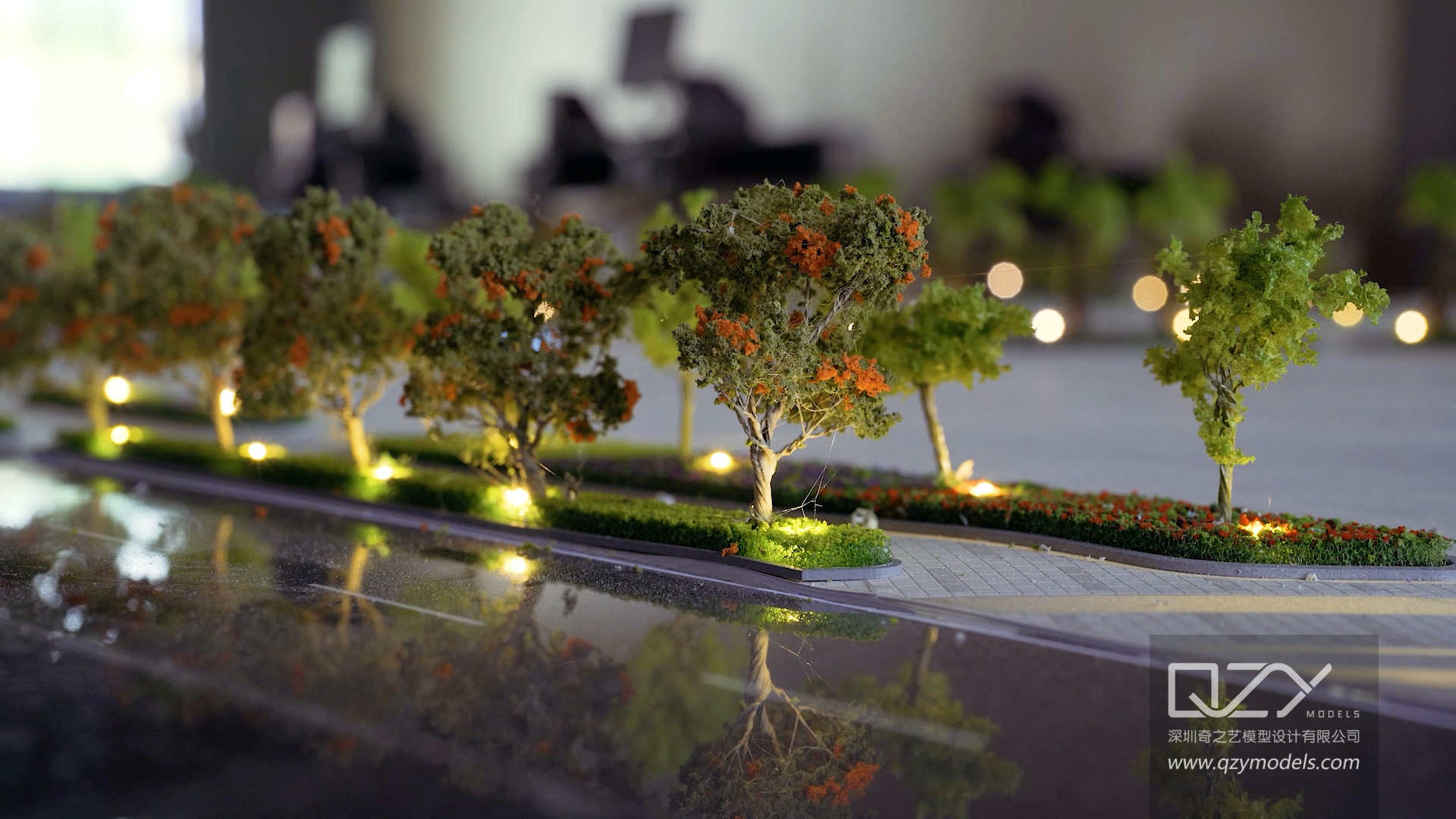
For park projects, QZY Models can integrate multiple layers into a single model: terrain, vegetation, water features, lighting elements, street furniture, and surrounding buildings. This layered design allows different stakeholders to focus on what matters most to them — for example, accessibility routes for governments, experiential quality for communities, or frontage and visibility for developers. The result is a 3D park model that is both technically faithful and visually compelling.
Which advantages does a 3D park model from QZY Models have over traditional methods?
Below is a structured comparison of traditional methods versus a professional 3D park model solution such as that provided by QZY Models.
What does the solution comparison look like?
| Aspect | Traditional 2D/Basic 3D Presentation | Professional 3D Park Model by QZY Models |
|---|---|---|
| Spatial understanding | Relies on users interpreting plans and elevations; high cognitive load | Immediate, intuitive understanding of height, distance, and relationships |
| Stakeholder engagement | Passive slide viewing; limited interaction | Interactive discussion around a shared physical object; higher engagement |
| Accuracy of context | Park often shown in isolation or simplified surroundings | Park integrated with buildings, roads, terrain, and landmarks at consistent scale |
| Communication speed | Requires repeated explanation by designers | Design intent is visible at a glance; fewer clarification rounds |
| Use scenarios | Mostly internal design reviews | Government approvals, investor pitches, public exhibitions, marketing |
| Adaptability | Difficult to update visuals once printed | Modular components can be swapped or updated in staged phases |
| Perceived value | Viewed as technical documentation | Viewed as a premium, credible representation of project seriousness |
| Cross-border communication | Vulnerable to drawing convention differences | Physical form minimizes language and symbol barriers |
How can you create a 3D park model step by step?
A structured workflow helps ensure your 3D park model is not only beautiful but also reliable for decision-making. Below is a practical, step-by-step process that design teams, developers, and institutions can follow.
-
Define objectives and audience
Clarify who will use the model (e.g., municipal review committee, investors, public exhibition) and what decisions it must support. Decide whether the emphasis is on environmental performance, user experience, investment value, or urban integration. -
Collect and organize design data
Prepare up-to-date CAD drawings, BIM models, topographic surveys, landscape plans, and surrounding building data. Confirm key parameters such as scale (e.g., 1:200, 1:500), model footprint size, and level of detail required for vegetation, furniture, and people. -
Collaborate with a professional model maker
Engage a specialized team such as QZY Models early in the process to review data, propose scale options, and identify potential clarity issues. At this stage, decisions about removable roofs, lighting integration, and sectional cuts can greatly increase communication impact. -
Develop a model design proposal
The model maker produces shop drawings, material specifications, and visualization of how the model will look and function. This can include zones with higher detail (e.g., central plaza) and simplified surroundings to keep cost and size under control while preserving context. -
Fabricate key components
Using CNC milling, laser cutting, and 3D printing, the team manufactures terrain, structures, and landscape elements. In QZY Models’ workflow, traditional craftsmanship is combined with advanced technologies to balance precision with visual realism, especially for complex geometries. -
Assemble, finish, and test
Components are assembled in a controlled environment, then refined through sanding, painting, and detailing. Lighting and moving elements (if any) are tested for reliability and ease of operation. Labels, legends, and protective covers are added to ensure the model can withstand repeated use. -
Package, ship, and install
For international or multi-site use, robust packing and a clear installation plan are essential. Providers like QZY Models offer global shipping and on-site installation services, ensuring the model arrives intact and is correctly set up for immediate use in exhibitions, showrooms, or government halls. -
Use, maintain, and update
Once in operation, the model should be periodically checked for dust, minor damage, or outdated details. Modular designs allow for targeted updates when phases of the park or surrounding development change, extending the model’s useful life across multiple project stages.
Why do client cases show strong impact when using 3D park models?
Real projects demonstrate how 3D park models can influence approvals, funding, and public perception. Below are four typical scenarios that reflect common client types for QZY Models.
Case 1: Real estate developer’s central park
Problem
A large residential developer planned a central park positioned as the project’s main selling point, but early sales events showed that buyers struggled to understand how the park connected to their buildings and daily routes.
Traditional approach
The marketing team used perspective renderings, brochures, and digital fly-throughs. While visually attractive, they did not clearly communicate elevation changes, sightlines from units, or the distribution of quiet vs. active zones.
Solution and effect with 3D park model
A detailed park model at 1:300 scale was created, incorporating key towers, main streets, and amenity nodes such as playgrounds and fitness areas. Sales staff could physically point to paths, entrances, and vantage points from different buildings. Visiting families quickly grasped where their unit sat relative to greenery and facilities.
Key benefits
-
Shorter explanation time per client visit
-
Higher confidence in park-related unit premiums
-
Clearer storytelling around lifestyle, supporting faster sales and stronger price acceptance
Case 2: Municipal urban planning and public consultation
Problem
A municipal planning department needed to upgrade an existing riverfront park while balancing flood protection, ecology, and public recreation. Prior consultations faced opposition because residents could not visualize how the upgrades would affect access and views.
Traditional approach
The team relied on printed masterplans, section drawings, and PowerPoint presentations. Many residents found them too technical and worried about losing open space or river views, generating resistance and petitions.
Solution and effect with 3D park model
A large-scale physical model of the riverfront corridor, including adjacent neighborhoods, bridges, and embankments, was produced. During public exhibitions, residents could walk around the model, identify their buildings, and see exactly how new terraces, planting areas, and paths would appear.
Key benefits
-
Reduction in objections based on misunderstanding
-
More constructive feedback focused on details instead of the general concept
-
Faster consensus-building, enabling the project to proceed with fewer redesign cycles
Case 3: International design competition entry
Problem
An architectural design firm participating in an international competition for a landmark urban park needed to clearly differentiate its proposal and make it easily understood by a mixed jury of officials, developers, and community representatives.
Traditional approach
Past competitions had relied heavily on boards and digital slides, where strong schemes sometimes underperformed because jurors could not fully appreciate their spatial qualities or circulation logic in a short review window.
Solution and effect with 3D park model
The firm commissioned a compact yet highly detailed 3D park model that highlighted key topographic moves, program zones, and visual axes. Jurors could immediately see how the design organized movement, views, and program intensities without needing to decode complex diagrams.
Key benefits
-
Stronger first impression during in-person presentations
-
Clear differentiation from competing entries with only 2D materials
-
Increased perceived professionalism and feasibility of the proposal
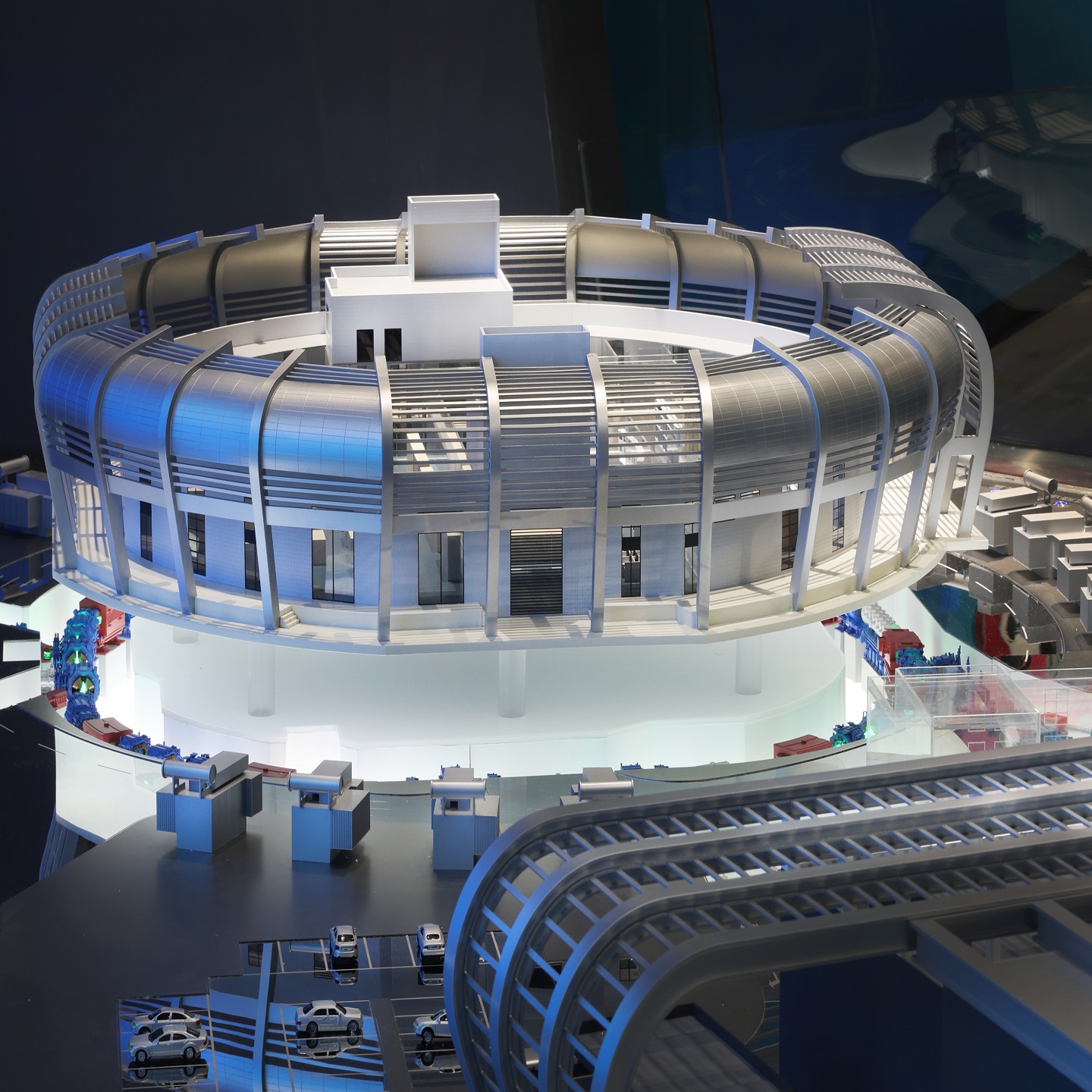
Case 4: Industrial campus landscape for a technology company
Problem
An industrial design company working with a technology client was tasked with reimagining the landscape of a multi-building campus to improve employee well-being and brand image. The client’s executives were skeptical about investing heavily in outdoor spaces.
Traditional approach
The design team prepared reports showing research on well-being, productivity, and outdoor environments. However, long documents and generic reference images failed to create a sense of urgency or a vivid picture of the transformed campus.
Solution and effect with 3D park model
A campus-wide 3D model was developed, with particular emphasis on walking routes, shaded seating areas, and outdoor collaboration zones. Executives could see how green spaces linked building entrances, parking, and amenities, making the benefits tangible.
Key benefits
-
Clear visualization of the return on investment in spatial terms (e.g., more usable outdoor meeting areas)
-
Faster budget approval for landscape upgrades
-
Stronger internal buy-in from multiple departments who shared the same physical reference
Why is now the right time to adopt professional 3D park models?
Cities, developers, and institutions are under increasing pressure to demonstrate the value and impact of parks and public spaces with clarity and evidence. New technologies such as advanced 3D printing and digital fabrication have lowered the barrier to creating highly detailed, durable models, making professional 3D park models more accessible than before.
At the same time, stakeholder expectations for visualization have risen. Whether in the Middle East, Europe, or Southeast Asia, clients and authorities are accustomed to high production values in presentations, especially for high-profile projects. Working with an experienced team like QZY Models helps ensure your 3D park model meets these expectations, combining precision with strong narrative power.
Looking ahead, the integration of physical models with augmented reality and interactive lighting will further enhance their role in planning and communication. Teams that establish a robust workflow for 3D park models today will be better positioned to adopt these hybrid approaches in the future, maximizing the value of every project presentation.
What are common questions about creating a 3D park model?
How long does it typically take to produce a professional 3D park model?
Timeframes vary based on scale, complexity, and level of detail, but most professional park models take several weeks from data confirmation to delivery. Engaging a provider early in the design process helps align deadlines with approvals and launch events.
What level of design development is needed before commissioning a model?
A model is most effective when major layout decisions are stable, but it can also support option comparison if designed modularly. Ideally, key plan, elevation, and landscape layers should be sufficiently developed to avoid major late changes.
Can a 3D park model be updated when the design evolves?
Yes, if planned properly. Modular construction and clearly defined zones allow specific areas to be replaced or upgraded without rebuilding the entire model, which is especially useful for phased developments or long-term masterplans.
Is it possible to integrate lighting and movement into the park model?
Lighting can be integrated to highlight pathways, buildings, and key landscape elements, while simple moving parts (e.g., transport elements) can illustrate flows. These features should be discussed early with the model maker to balance impact, budget, and durability.
Who benefits most from investing in a professional 3D park model?
Architectural design firms, real estate developers, planning authorities, landscape design studios, exhibition organizers, and educational institutions all gain from clearer communication and stronger engagement. For international projects, a high-quality 3D park model from an experienced provider like QZY Models is especially valuable in bridging cultural and technical gaps.