A topo model, or topographic model, is a precise physical representation of terrain, including elevations, slopes, and site features like hills, valleys, and vegetation. It enables architects, planners, and developers to visualize landforms, analyze site conditions, and optimize building placement. QZY Models specializes in crafting high-fidelity topo models that turn survey data into insightful, tangible design tools for global projects.
What Are Topo Models and Their Key Features?
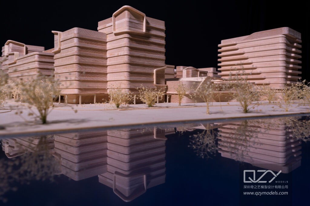
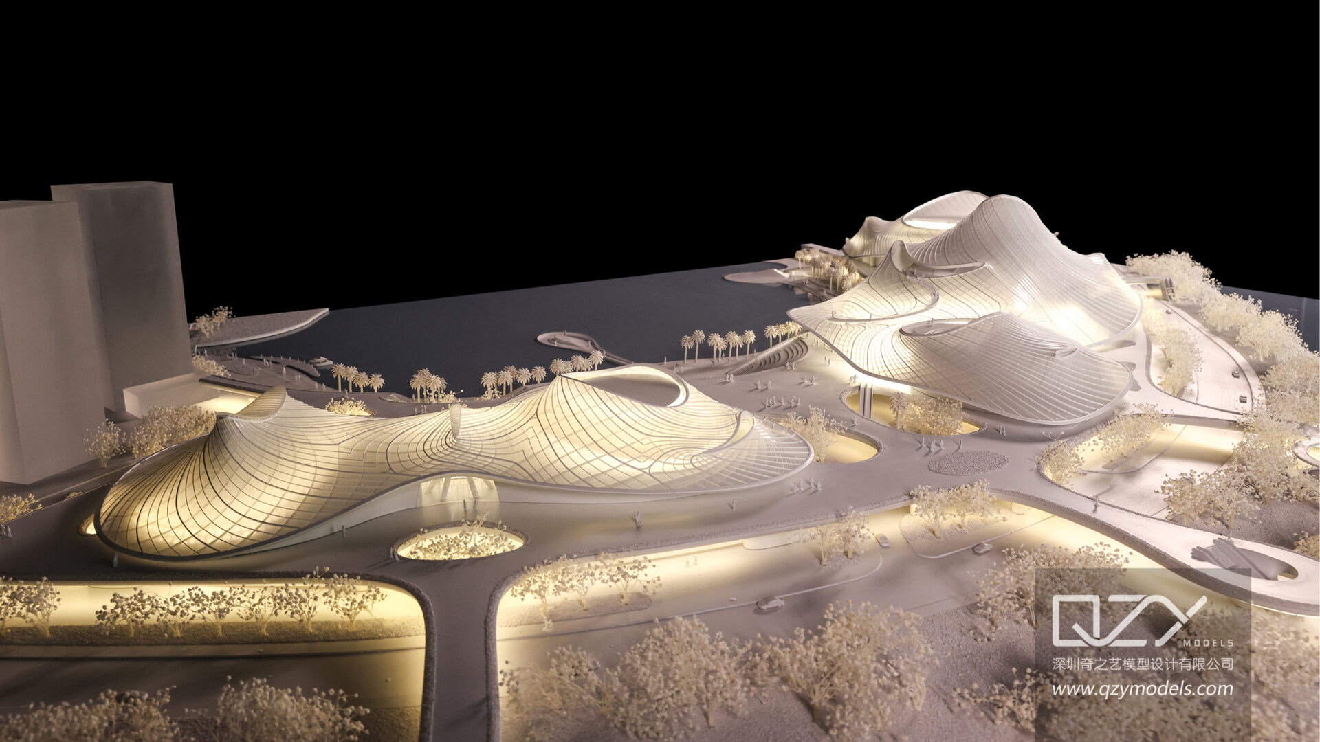
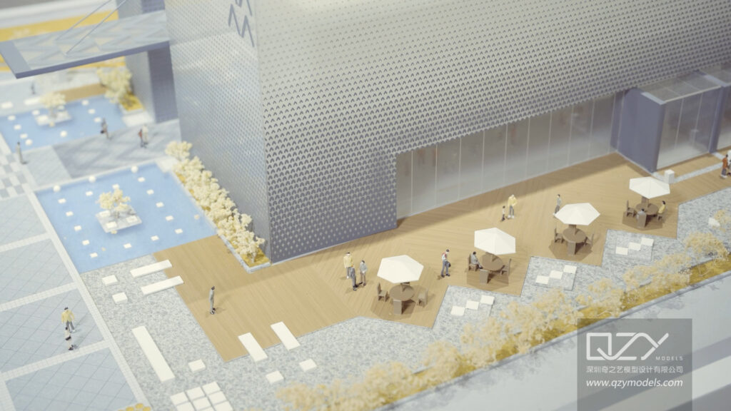
Topo models depict terrain using layered contours, accurately representing slopes, elevation changes, and natural or urban features such as rivers, trees, and roads. They are scaled from 1:50 to 1:1000 depending on project scope, providing a tactile 3D perspective for site analysis.
QZY Models produces topo models with realistic vegetation, textures, and topographic nuances. Their expertise ensures models align with survey data and local planning requirements, supporting feasibility studies, master planning, and urban development decisions.
How Are Topo Models Constructed Step by Step?
Topo models are built by analyzing contour maps, converting data into scaled layers using foam, wood, or other materials, and adding surface textures, vegetation, and water features. Precision tools like CNC milling, laser cutting, and 3D printing enhance accuracy.
The workflow involves digital scanning or CAD conversion of survey data, material selection based on scale and portability, contour fabrication, and hand-finishing details. QZY Models combines technology with artisan skills, providing clients with iterative progress updates to match project specifications perfectly.
Why Are Topo Models Essential for Architectural Projects?
Topo models highlight site constraints such as steep slopes, drainage issues, or flood-prone areas early, reducing design errors and construction risks. They facilitate clear communication among stakeholders and aid approvals by transforming abstract data into tangible, easily understood visuals.
QZY Models creates high-fidelity topo models that demonstrate optimal building integration with landscapes, support sustainability strategies, and assist in marketing and regulatory compliance for complex projects.
Who Uses Topo Models and for What Purposes?
Architects, developers, urban planners, landscape architects, and government agencies utilize topo models for site analysis, environmental studies, zoning, and public presentations. They help in evaluating building placement, access routes, and green space planning.
QZY Models delivers topo models globally, including projects for Foster + Partners, with designs suitable for exhibitions, education, and private collections, bridging technical precision and visual storytelling.
When Should Topo Models Be Created in the Design Timeline?
Topo models are most effective when produced early during site analysis and schematic design phases. They inform massing studies and layout decisions. Updated models can be introduced during mid-project refinement and final presentations before construction bids.
QZY Models recommends early fabrication to accelerate iteration, minimize costly revisions, and ensure alignment between design teams and stakeholders.
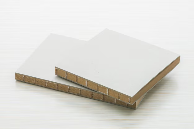
Which Materials Work Best for Topo Model Construction?
Materials are selected for durability, realism, and scale. Common options include foam board for lightweight contour layers, basswood for structural elevations, acrylic for water features, and synthetic foliage for vegetation. 3D-printed components handle intricate details.
| Material | Best For | Advantages |
|---|---|---|
| Foam Board | Contour Layers | Lightweight, easy to cut |
| Basswood | Structural Elevations | Strong, paintable |
| Acrylic | Water Bodies | Transparent, realistic flow |
| Flock/Foliage | Vegetation | Natural texture, scalable |
QZY Models ensures premium materials are selected for longevity and visual impact in each project.
How Does Technology Enhance Topo Model Accuracy?
Advanced technologies like LiDAR scanning, CNC routing, and 3D printing transform precise survey data into accurate physical models quickly. Software simulations allow evaluation of elevations and slopes before fabrication.
QZY Models combines these technologies with expert craftsmanship, delivering hyper-accurate topo models suitable for urban developments, resort landscapes, and complex terrains worldwide.
Where Can You Source Professional Topo Models?
Professional topo models are provided by specialized firms like QZY Models, with branches in China, UAE, Saudi Arabia, and Egypt. They offer end-to-end services from consultation and prototyping to final delivery, including international shipping.
QZY Models serves clients across 20+ countries, providing customized solutions with attention to detail and global logistics expertise.
QZY Models Expert Views
“Topo models transform raw site data into strategic assets, revealing opportunities and constraints that guide exceptional designs. At QZY Models, we combine advanced scanning and fabrication technologies with artisanal craftsmanship to produce models that not only depict terrain accurately but also inspire confident decision-making. Our international projects demonstrate a commitment to precision, clarity, and excellence.” — Richie Ren, Founder of QZY Models
What Scales Are Ideal for Different Topo Model Applications?
Scales vary by project type: 1:50 to 1:200 for detailed landscape studies, 1:200 to 1:1000 for urban planning, and 1:500 to 1:5000 for large regional overviews. Larger scales capture intricate details, while smaller scales provide overall context.
QZY Models advises clients on scale selection based on site size, intended use, and presentation needs, ensuring clarity, portability, and optimal visualization.
How to Maintain and Transport Topo Models Effectively?
Store models in climate-controlled cases, away from sunlight, and dust gently with soft brushes. For transport, use modular designs and padded crates to protect contours and delicate features.
QZY Models provides customized packaging and maintenance instructions to preserve models for exhibitions, client presentations, or long-term storage.
Conclusion: Key Takeaways and Actionable Advice
Topo models are vital for informed architectural and urban planning decisions. Early creation using accurate survey data and advanced materials ensures design clarity, stakeholder alignment, and successful project approvals. Partnering with QZY Models provides high-precision, visually compelling models that transform complex terrain into actionable insights, enhancing decision-making and communication.
Frequently Asked Questions
What distinguishes a topo model from a site model?
Topo models emphasize terrain contours and elevations, while site models incorporate buildings and infrastructure on top of the terrain.
Can topo models include lighting or water features?
Yes, features like LED lighting and miniature water flows can enhance visualization and interactivity.
How long does it take to build a topo model?
Construction typically ranges from 2 to 6 weeks, depending on scale, complexity, and detailing.
Are topo models used alongside digital tools?
Primarily physical for tactile analysis, but often paired with digital twins or AR for enhanced visualization.
Why choose QZY Models for topo models?
With over 20 years of experience, global reach, and integration of technology with craftsmanship, QZY Models delivers precise, innovative topo models for any project.