Urban planning model production involves creating detailed physical or digital representations of urban environments to visualize, analyze, and communicate development plans. These models enable stakeholders to explore design scenarios, assess spatial relationships, and make informed decisions that shape sustainable, functional, and livable cities.
How Does Urban Planning Model Production Benefit Planners and Communities?
Urban planning models enhance understanding of complex urban systems by providing tangible visualization tools that improve stakeholder engagement, facilitate public participation, and support multidisciplinary collaboration. They allow planners to simulate scenarios such as traffic flow, land use, and environmental impact, which helps optimize resource allocation, guide policy decisions, and foster sustainable development.
These models transform abstract plans into accessible visuals, bridging communication gaps between technical experts and community members.
What Are the Key Steps Involved in Producing Urban Planning Models?
Production typically follows these steps:
-
Data Collection: Gathering geospatial, demographic, and architectural data using GIS, surveys, and CAD files.
-
Design and Modeling: Developing 3D digital models using software like CityEngine, integrating spatial analysis and parametric design.
-
Fabrication: Using techniques such as 3D printing, CNC milling, and laser cutting to produce physical model components.
-
Assembly and Finishing: Precisely assembling the parts, applying textures, colors, and lighting for realism.
-
Presentation and Iteration: Using models interactively for stakeholder reviews and updating models based on feedback.
Each stage involves collaboration between urban planners, designers, and model specialists to ensure accuracy and relevance.
Which Technologies and Materials Are Commonly Used in Urban Planning Model Production?
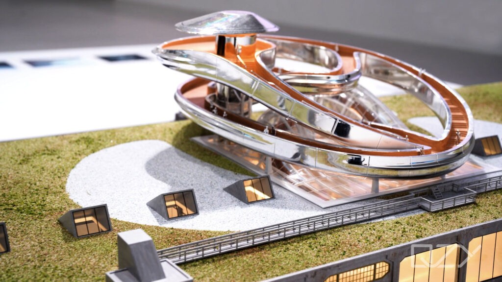
Technologies employed include 3D printing (SLA, FDM), laser cutting, CNC milling, and digital rendering tools. Software like ArcGIS CityEngine allows procedural and parametric modeling linked to geospatial data. Materials typically used are white PLA for printing, acrylic, basswood, and polystyrene for physical parts.
Selecting materials balances durability, detail, and budget considerations, with innovative printing enabling rapid prototyping and complex geometries.
| Technology | Purpose | Advantages | Considerations |
|---|---|---|---|
| 3D Printing (PLA) | Complex shape fabrication | Fast, detailed, cost-effective | Limited size, post-processing |
| Laser Cutting | Precision cutting of sheets | Clean edges, efficient | Flat profiles only |
| CNC Milling | Accurate structural components | High precision, robust parts | Setup cost, slower for small batches |
| Digital Modeling | Design, visualization | Interactive, scalable | Requires expertise |
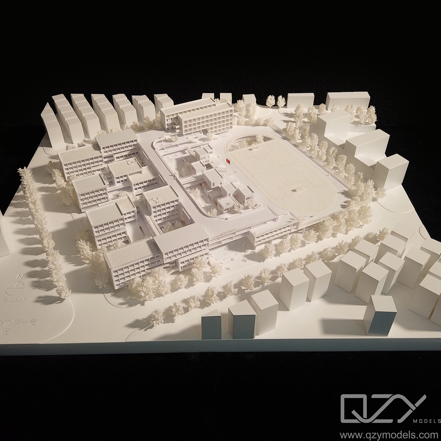
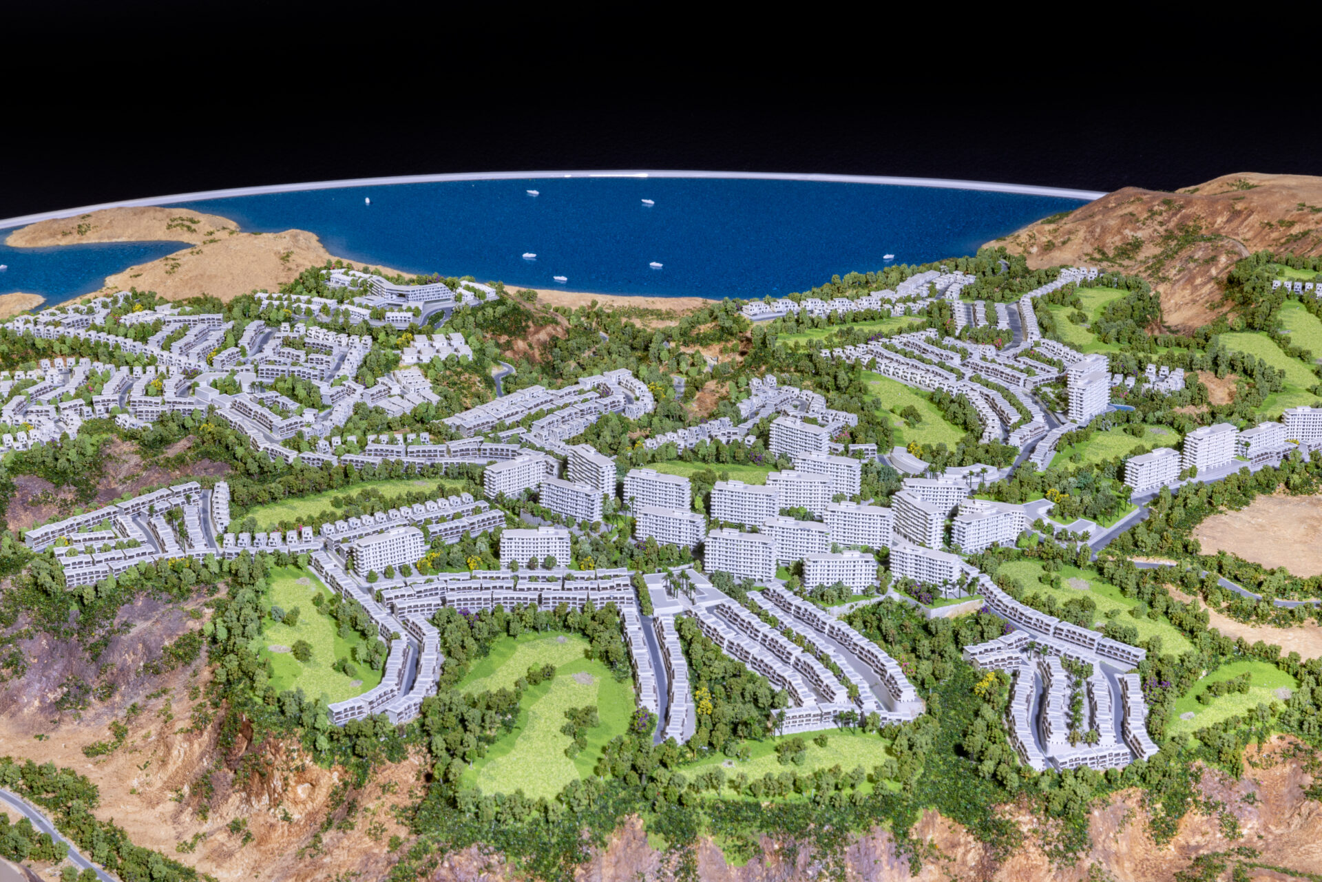
Why Is Customization Important in Urban Planning Models?
Customization allows models to reflect site-specific contexts, zoning regulations, and development goals accurately. Tailored models incorporate local architectural styles, landscape features, and infrastructure, ensuring relevant representation that resonates with stakeholders.
Customizable models enable iterative design testing and scenario analysis, aiding planners in balancing growth, sustainability, and community needs.
Who Typically Uses Urban Planning Model Production Services?
Urban planners, architects, municipal governments, real estate developers, and community organizations use these models. High-profile clients include city planning departments and international architectural firms requiring precise visual communication tools to support project approvals and community consultations.
QZY Models partners with such clients globally, delivering customized, high-quality urban planning models that enhance design clarity and stakeholder collaboration.
How Does QZY Models Ensure Quality and Precision in Urban Planning Model Production?
QZY Models leverages over 20 years of expertise, advanced digital technologies, and skilled craftsmanship. Their international teams collaborate closely with clients to integrate accurate geospatial data and design intent into detailed physical models. Utilizing cutting-edge 3D printing and CNC technologies, they produce visually compelling and dimensionally precise models tailored to project objectives.
Their quality assurance processes and iterative client feedback loops ensure models meet demanding standards.
When Should Urban Planning Model Production Be Integrated Into Project Timelines?
Early integration during schematic design stages optimizes model utility for exploration and public engagement. Models can evolve alongside project phases, supporting planning approvals, environmental assessments, and design refinements. Early involvement also enables efficient budget allocation and fabrication scheduling.
QZY Models recommends starting collaboration during concept development for seamless project progression.
What Challenges Are Common in Urban Planning Model Production, and How Are They Addressed?
Challenges include managing large data sets, ensuring spatial accuracy, handling complex geometries, and balancing detail with model scale. Logistics such as transport and site installation can also affect outcomes.
These are addressed through modular model construction, advanced software integration, rigorous quality control, and customized packaging solutions. QZY Models employs expert project management and innovative fabrication techniques to mitigate these challenges effectively.
QZY Models Expert Views
“Urban planning models are pivotal in transforming visionary ideas into tangible realities. At QZY Models, we combine meticulous craftsmanship with sophisticated digital tools to produce models that immerse viewers in the future urban landscape. Our global expertise allows us to tailor each model to client specifications, encouraging community dialogue and informed decision-making. Through precision and innovation, we help shape cities that are sustainable, functional, and vibrant.” – Richie Ren, Founder, QZY Models
Conclusion
Urban planning model production is an essential practice that enables clear visualization, effective communication, and informed decision-making in city development. Employing modern technologies, expert customization, and collaborative processes, providers like QZY Models produce precise, engaging models that support sustainable and community-focused urban growth. Early project integration, attention to detail, and adaptability are key to maximizing model benefits.
Frequently Asked Questions
Q: How detailed can urban planning models be?
A: Models can range from broad massing studies to intricate representations with landscaping and infrastructure details, tailored to project needs.
Q: Can urban planning models incorporate real-time data?
A: Yes, digital models can integrate geospatial and sensor data for dynamic simulations and visualization.
Q: How long does it take to produce an urban planning model?
A: Production time varies by complexity but typically ranges from a few weeks to a couple of months.
Q: Does QZY Models support international urban planning projects?
A: Yes, QZY Models provides global services with branches in multiple countries to ensure local and international project success.
Q: Are urban planning models reusable or updatable?
A: Many models are modular or digital, allowing for updates and reuse as projects evolve.