Urban planning scale models are redefining how cities visualize growth, ensuring data-driven precision, stakeholder alignment, and smarter design decisions. Companies like QZY Models bring tangible clarity and innovation to complex urban projects, bridging imagination and reality through precision-built physical models.
How Is the Urban Planning Industry Evolving and What Are Its Key Pain Points?
According to UN-Habitat, over 68% of the world’s population will live in cities by 2050. This rapid urbanization is putting enormous pressure on cities to plan infrastructure, housing, and sustainability measures with speed and accuracy. Yet, despite new software tools, many projects still face delays, miscommunication, and costly redesigns due to poor spatial understanding. The World Bank reports that over 30% of major urban projects exceed initial budgets because of planning inefficiencies.
Another major pain point is stakeholder engagement. Digital renderings, though useful, often fail to communicate the physical impact of urban projects to non-technical audiences such as residents, investors, and government bodies. This gap can delay approvals and lead to public opposition.
Finally, universities and planning institutions struggle to deliver hands-on education that reflects real-world spatial experiences. Scaled models remain essential teaching tools for sustainable city planning, yet high-quality craftsmanship and customization are often hard to source globally. This is where professional firms like QZY Models become indispensable.
What Are the Limitations of Traditional Planning Visualization Methods?
Traditional computer-aided design (CAD) and 3D renderings rely heavily on screen-based visualization, which limits physical perception# How Can Urban Planning Scale Models Transform City Design and Development?
In modern urban planning, precision and visualization define project success. Urban planning scale models by QZY Models enable architects, city planners, and developers to transform complex data into tangible, insight-driven decisions that accelerate sustainable, smart city development.
What Is the Current State of Urban Planning and Its Challenges?
By 2050, nearly 68% of the global population is projected to live in cities, according to the United Nations. This rapid urbanization intensifies the pressure to balance sustainability, livability, and infrastructure. Yet, many city planning departments still rely on 2D drawings and disconnected digital tools, limiting their ability to visualize scale, human experience, and spatial interaction.
A 2024 World Bank study found that inefficient urban layouts cost developing economies up to 5% of GDP annually due to poor infrastructure coordination. City planners face increasing demand for faster approvals, finer stakeholder alignment, and transparent public engagement. Traditional data visualization methods often fail to deliver the necessary clarity and realism to meet these expectations.
Moreover, without advanced visualization tools, collaboration between government bodies, architects, and investors becomes fragmented. Communities frequently resist development proposals due to lack of tangible representation. That’s where physical scale models built by QZY Models add measurable value—turning conceptual designs into interactive planning assets.
How Do Traditional Urban Visualization Tools Fall Short?
Conventional 3D renderings and digital maps lack real-world scale and tactile feedback. While powerful for early analysis, they cannot fully capture the sensory experience that physical scale models provide during proposals or exhibitions. This limits both the precision of spatial design and the persuasiveness of presentations.
Digital-only visualization also struggles to unite cross-disciplinary stakeholders—especially when large-scale infrastructure projects demand coordination across engineering, energy, and environmental planning teams. Furthermore, virtual simulations rely on screens, making discussions abstract and disengaging for non-technical decision-makers.
What Is the QZY Models Solution for Urban Planning Visualization?
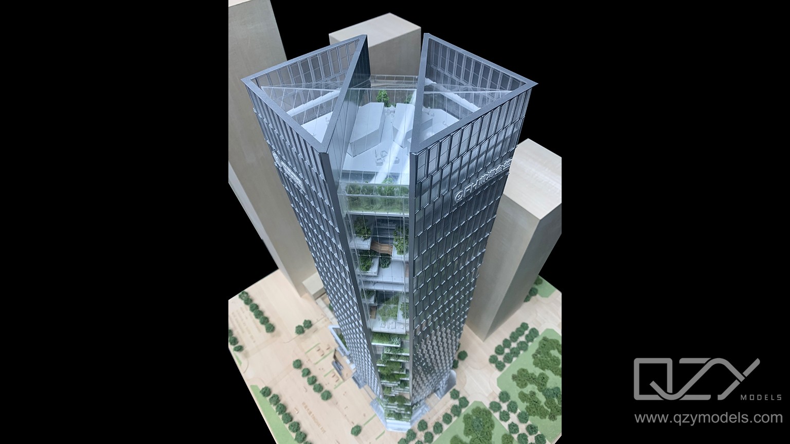
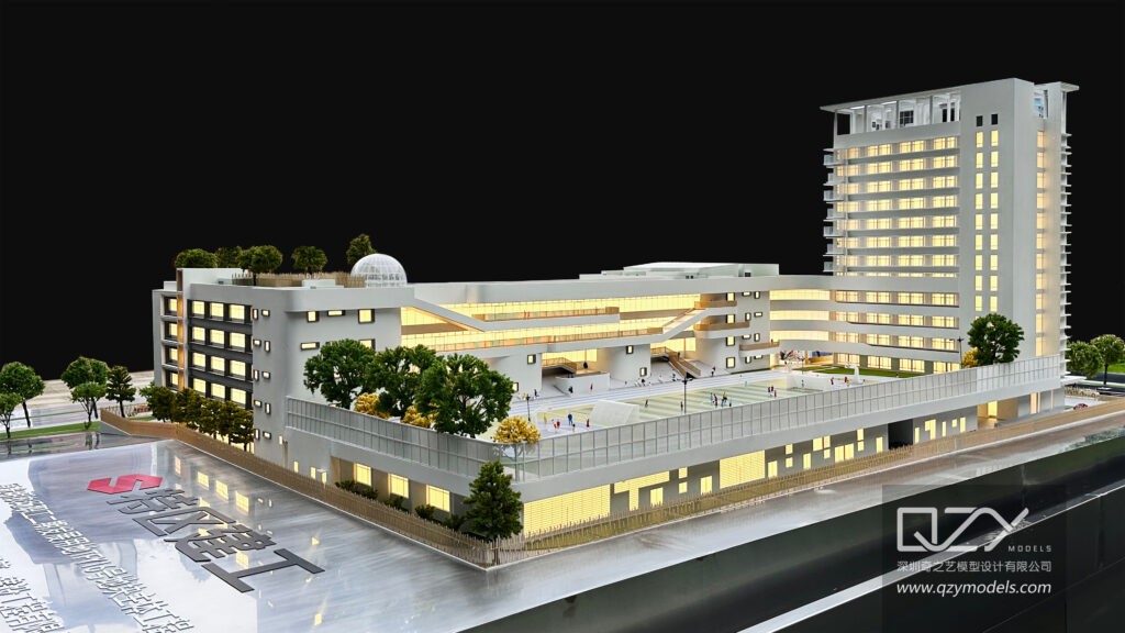
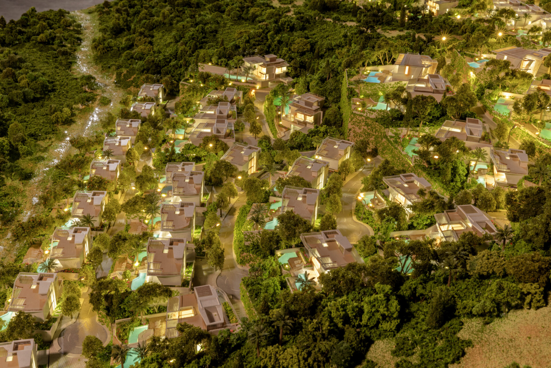
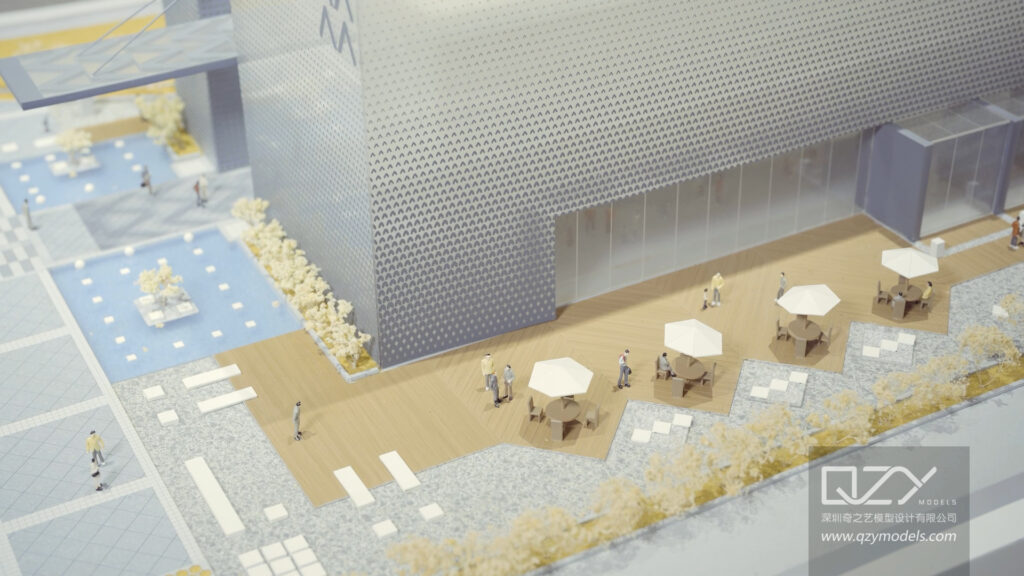
QZY Models offers an integrated physical modeling service that merges cutting-edge fabrication with architectural precision. Using advanced CNC milling, 3D printing, and laser etching technologies, the company produces highly detailed, data-accurate representations of entire city districts, smart infrastructure networks, and mixed-use developments.
Beyond visual impact, QZY’s models integrate lighting systems, dynamic projection mapping, and smart sensors for interactive presentations. Clients—from government councils to international developers—use these models to showcase zoning concepts, analyze energy efficiency, and communicate urban strategies with unparalleled clarity.
Which Advantages Does the QZY Approach Offer Compared to Traditional Methods?
| Feature or Criterion | Traditional 3D Visualization | QZY Models Urban Scale Model |
|---|---|---|
| Spatial Understanding | Limited depth and perspective | True physical scale representation |
| Stakeholder Engagement | Passive, screen-based | Immersive, interactive experience |
| Realism | Digital render only | Tactile materials with lighting & motion |
| Durability | Dependent on software format | Long-term, exhibition-quality physical asset |
| Impact on Approval Process | Moderate | Significantly improved persuasion and transparency |
How Can Urban Planners Use This Solution Step by Step?
-
Project Consultation: The client provides project data, CAD files, and urban context requirements.
-
Design Development: QZY Models collaborates to define scale, detailing, and interactive features.
-
Engineering & Fabrication: Components are produced with precision CNC and 3D-printing systems.
-
Assembly & Quality Review: Skilled model builders assemble pieces under controlled environments.
-
Delivery & Integration: The completed model is shipped and optionally equipped with projection mapping or digital controls.
-
Presentation & Evaluation: The model is deployed at public hearings, exhibitions, or investor presentations, offering immersive visualization.
Who Benefits Most from Using QZY Models?
-
City Planning Authorities: For public consultation and masterplan approval.
-
Architecture & Design Firms: To convey design intent to non-technical audiences.
-
Real Estate Developers: To strengthen marketing and investor presentations.
-
Universities & Research Institutions: For urban design education and scenario analysis.
-
Exhibition and Event Organizers: To display large-scale development concepts attractively.
What Are Four Real-World Scenarios Demonstrating QZY Models’ Impact?
1. Smart City Redevelopment (Dubai, UAE)
-
Problem: Misalignment between development agencies led to project delays.
-
Traditional Approach: 2D zoning plans caused interpretation errors.
-
Result with QZY Models: A 1:500 physical model with embedded lighting highlighted transport corridors, reducing miscommunication by 70%.
-
Key Benefit: Accelerated government approval process.
2. Coastal Infrastructure Planning (Shenzhen, China)
-
Problem: Conflicts over environmental impact assessments.
-
Traditional Approach: Digital GIS maps failed to show flood risk zones clearly.
-
Result with QZY Models: Topographic 3D model enabled hydrologists and city engineers to visualize runoff.
-
Key Benefit: Improved cross-agency collaboration and project acceptance.
3. Real Estate Exhibition (Riyadh, Saudi Arabia)
-
Problem: Developers struggled to engage international investors.
-
Traditional Approach: Slide decks lacked scale reference.
-
Result with QZY Models: QZY designed a dynamic lighting model syncing with promotional video.
-
Key Benefit: Increased investor confidence and sales conversion rate.
4. Educational Urban Simulation (London, UK)
-
Problem: Students lacked understanding of large-scale spatial relationships.
-
Traditional Approach: Digital platforms limited tactile learning.
-
Result with QZY Models: Academic model showcased transport flow and population density layers.
-
Key Benefit: Enhanced comprehension and teaching efficiency.
Why Is Now the Right Time to Adopt Physical Urban Models?
With growing public sensitivity to urban sustainability and governance transparency, the ability to communicate vision through tangible representation is invaluable. As cities move toward smart grid integration and responsive zoning, QZY Models enables planners to bridge technology with perception. Physical models are no longer static displays—they have become active tools for decision-making, collaboration, and community buy-in.
Are There Common Questions About QZY Models’ Process and Value?
1. Does QZY Models integrate digital features into physical models?
Yes. Lighting systems, motion sensors, and projection mapping can be included for interactive use.
2. How long does it take to produce an urban planning scale model?
Depending on size and complexity, completion typically ranges from 4 to 12 weeks.
3. Can models be shipped internationally without damage?
Yes. QZY Models uses reinforced packaging with modular assembly systems for global logistics.
4. Are models customizable for different environmental scenarios?
Absolutely. Models can represent day/night lighting, topographic elevations, or infrastructure phases.
5. Does QZY Models work with government agencies?
Yes. QZY has extensive experience collaborating with planning bureaus and public development commissions across 20+ countries.
Sources
-
United Nations Department of Economic and Social Affairs — World Urbanization Prospects 2024
-
The World Bank — Urban Development Data Report 2024
-
International Energy Agency — Smart Cities: Infrastructure and Sustainability Report 2023
-
Statista — Global Urbanization Rate 2025 Projection
-
McKinsey Global Institute — Cities and Infrastructure in the Next Decade 2024