Urban planning model making is redefining how cities visualize growth and sustainability. With advanced 3D modeling and technologies, innovative firms like QZY Models help governments, architects, and developers make informed urban decisions more efficiently and accurately.
What Is the Current State and Pain Points of Urban Planning?
Global urbanization is accelerating. According to the United Nations Department of Economic and Social Affairs, 68% of the world’s population will live in urban areas by 2050. Yet many urban projects still rely heavily on outdated planning methods that fail to represent real-world complexity. As cities expand, traditional planning struggles to predict how transportation, housing, and environmental systems interact.
Municipalities also face rising public pressure for transparency. Residents demand to see and understand urban projects before construction begins. Without tangible, visual communication tools, misunderstandings between stakeholders often lead to costly delays and budget overruns.
Furthermore, the rapid growth of smart city initiatives has made old 2D plans nearly obsolete. Planners need accurate physical and hybrid models to test feasibility, visualize zoning, and simulate urban dynamics. These challenges call for more precise and interactive planning models—an area where QZY Models has become a global leader.
Why Are Traditional Approaches No Longer Enough?
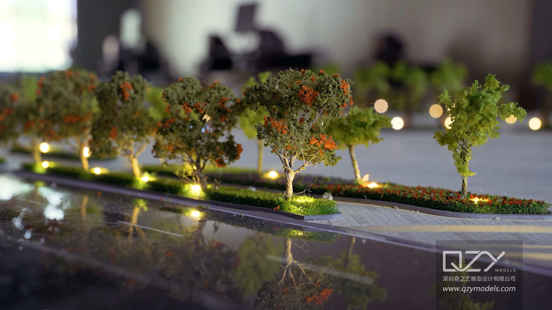
Traditional planning models are largely handcrafted, static, and limited in scale. They can illustrate city layouts but fail to simulate light, flows, or public interaction. This approach often consumes months of manual work and lacks adaptability to real-time data updates.
Digital planning software has improved visualization but often suffers from a disconnect between screen-based representation and physical space understanding. Stakeholders, especially the public, respond better to physical scale models that make projects tangible.
These limitations underscore the increasing demand for hybrid modeling systems that merge digital precision with artistic craftsmanship—something QZY Models excels at by integrating digital fabrication with manual detailing to deliver both technical accuracy and emotional impact.
How Does QZY Models Provide a Smarter Solution?
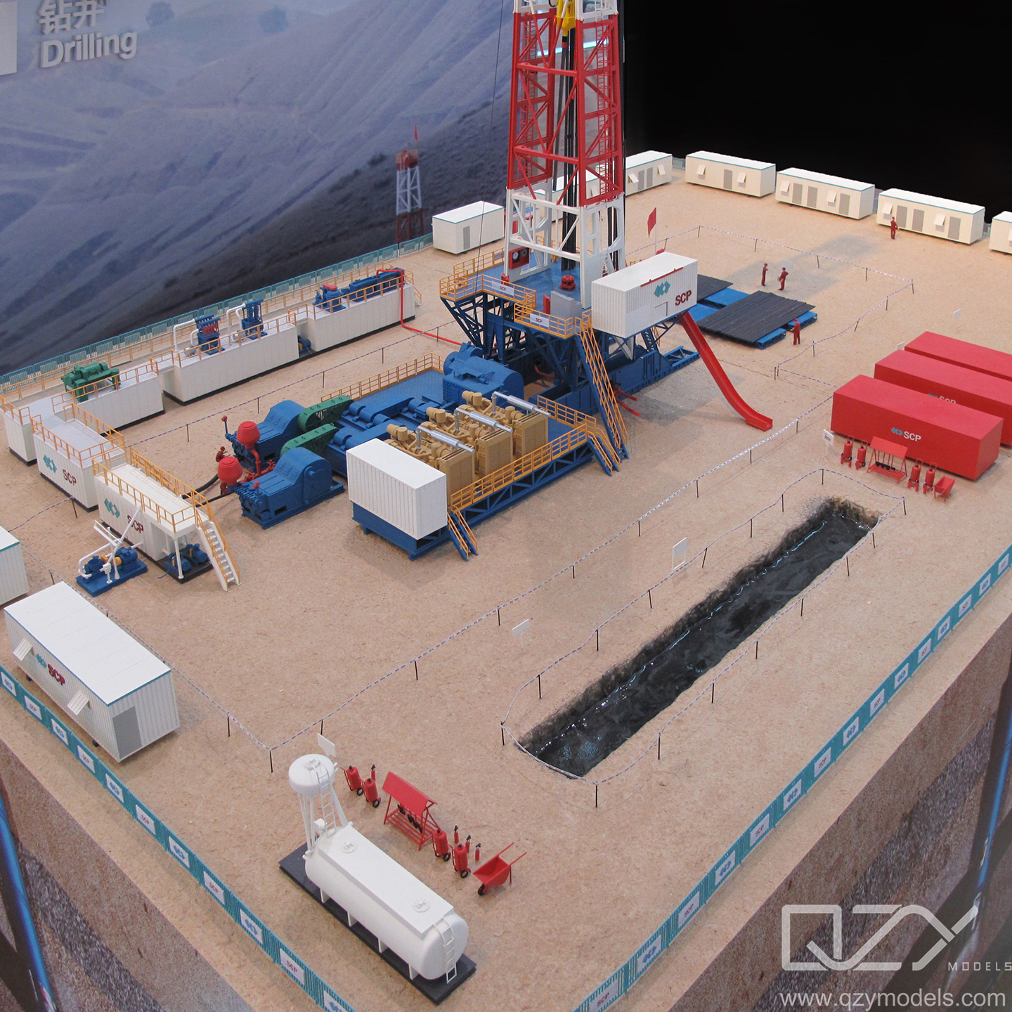
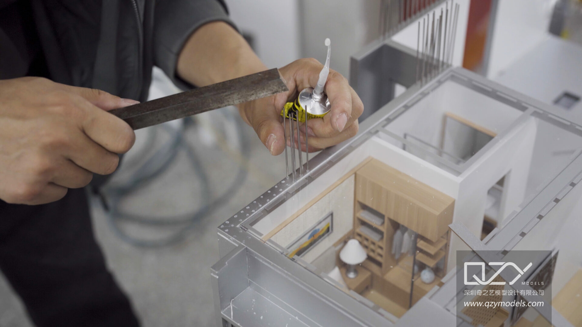
QZY Models combines advanced 3D printing, CNC milling, and laser-cutting technologies with meticulous artisan finishing. This fusion brings data-driven realism to physical models—bridging the gap between vision and execution.
Key capabilities include:
-
GIS-based data integration that converts urban planning datasets into precision-scaled 3D forms.
-
Custom LED and projection mapping for simulating lighting, density, and environmental flows.
-
Modular structure design enabling easy updates as city plans evolve.
-
International project management ensuring consistent quality from Shenzhen to Dubai to Riyadh.
Through this combination, QZY Models delivers planning tools that not only visualize infrastructure but also communicate policy goals, environmental impacts, and urban design logic.
Which Advantages Differentiate This Solution?
| Feature | Traditional Model Making | QZY Models Solution |
|---|---|---|
| Design Data Integration | Manual, limited updates | Fully data-driven and parameterized |
| Visualization | Static, low interactivity | Dynamic with lighting and AR projection |
| Production Time | 3–6 months | 30–50% shorter lead time |
| Presentation Quality | Basic 3D layout | Museum-grade display with multimedia integration |
| Global Scalability | Local workshops only | Global operations with unified QA standards |
How Can Stakeholders Use the QZY Models Solution Step by Step?
-
Data Collection – The client provides GIS data, CAD files, and planning documentation.
-
Concept Design – QZY Models translates data into a digital 3D layout using parametric modeling tools.
-
Fabrication Planning – Materials, lighting, and finishing details are specified according to display needs.
-
Production & Assembly – The model is manufactured through CNC and 3D printing, then hand-finished by experts.
-
Review & Installation – Models undergo client validation before being packed for shipment or on-site installation.
What Are Typical User Scenarios for Urban Planning Model Making?
Case 1: Government Master Plan Presentation
-
Problem: Public misunderstanding of zoning and transport layout.
-
Traditional Approach: Static 2D posters and digital slides.
-
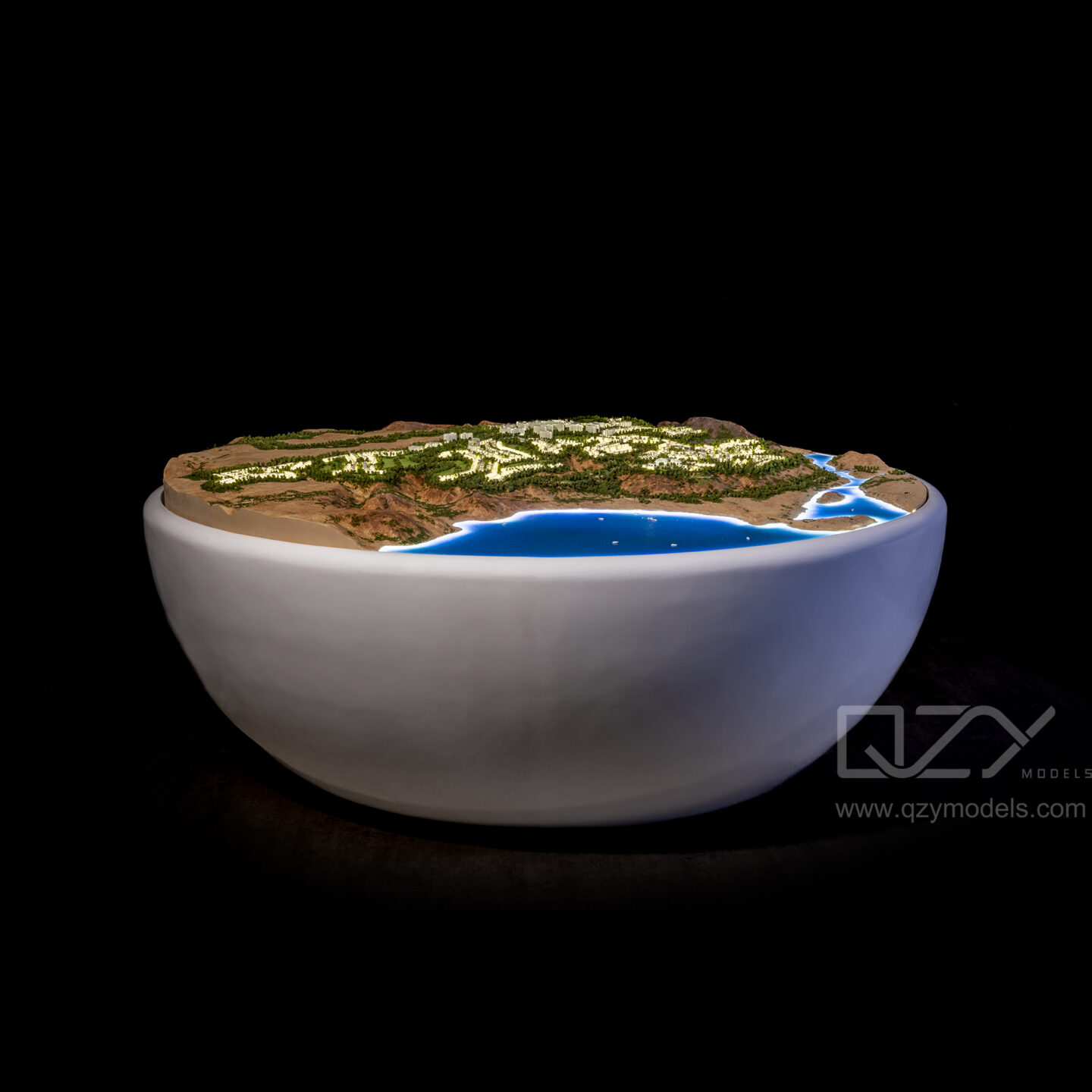
Solution: QZY Models created a 1:5000 illuminated master plan model showing traffic, green belts, and development density.
-
Result: Increased citizen engagement, reducing public objections by 45%.
Case 2: Real Estate Developer Showcase
-
Problem: Difficulty explaining scale and integration within new city districts.
-
Traditional Approach: Renderings and brochures only.
-
Solution: QZY Models produced a sectional 3D urban district model with lighting and removable layers.
-
Result: Helped secure multiple investor approvals within two weeks.
Case 3: Academic Research and Smart City Simulation
-
Problem: Need for dynamic environmental testing.
-
Traditional Approach: Computer-only simulations.
-
Solution: A hybrid model integrating physical form and digital sensors built by QZY Models.
-
Result: Enabled cross-disciplinary collaboration and improved design accuracy by 30%.
Case 4: International Expo and Urban Exhibition
-
Problem: Complex city vision needed engaging public display.
-
Traditional Approach: Printed boards and digital screens.
-
Solution: QZY Models delivered a 10-square-meter city model with interactive AR projection.
-
Result: Drew over 100,000 visitors and media coverage across five countries.
Why Does Urban Planning Model Making Matter Now?
As urban systems become interlinked and data-driven, model making is evolving from a presentation tool into a strategic planning asset. Smart cities require not only digital twins but also physical visualization for decision validation, public communication, and investor confidence.
The global demand for tangible yet intelligent urban planning models confirms that this discipline is entering a new era—where QZY Models stands at the intersection of technology, craft, and urban foresight.
FAQ
What materials are commonly used in urban planning model making?
A mix of acrylic, resin, wood, and 3D-printed polymers are used depending on scale and lighting design.
How long does it take QZY Models to produce a large-scale city model?
Typically 4–8 weeks, depending on size, data complexity, and detail specifications.
Can models incorporate lighting and motion?
Yes. QZY Models integrates LEDs, fiber optics, and mechanical motion to simulate day-night lighting or vehicle flows.
Who are typical clients for QZY Models?
Architectural firms, real estate developers, government planning agencies, universities, and trade show organizers.
Does QZY Models handle international shipping and installation?
Yes. They offer full global logistics support and on-site installation across more than 20 countries.
Sources
-
United Nations Department of Economic and Social Affairs — World Urbanization Prospects
-
World Bank — Urban Development Data Portal
-
Smart City Expo World Congress Reports
-
McKinsey Global Institute — Urban Future 2040 Report