Landscape and urban planning models provide precise, three-dimensional representations of city layouts and green spaces, enabling architects, planners, and stakeholders to visualize, analyze, and optimize urban environments. These models facilitate better communication, sustainable design, public engagement, and informed decision-making, helping to create vibrant, resilient, and functional urban communities.
What Are Landscape and Urban Planning Models and Why Are They Essential?
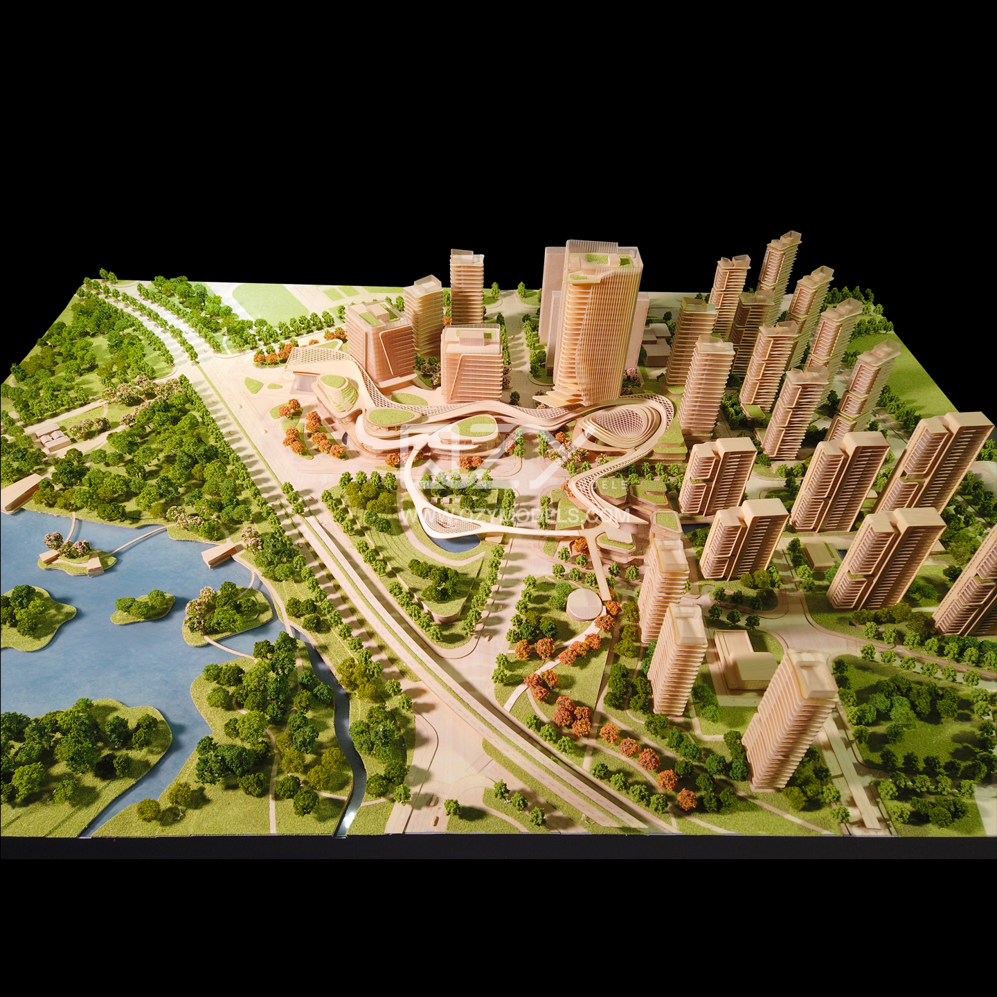
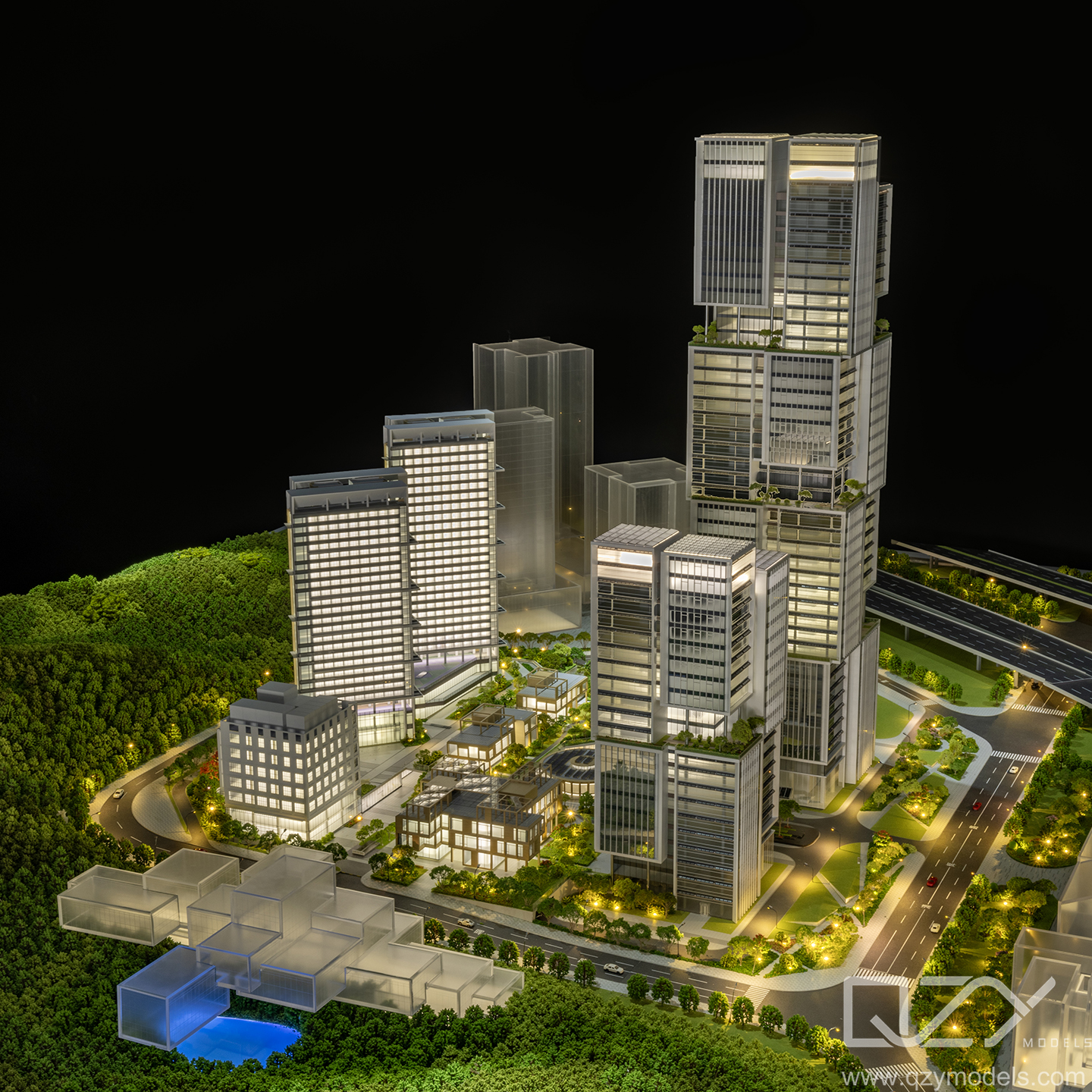
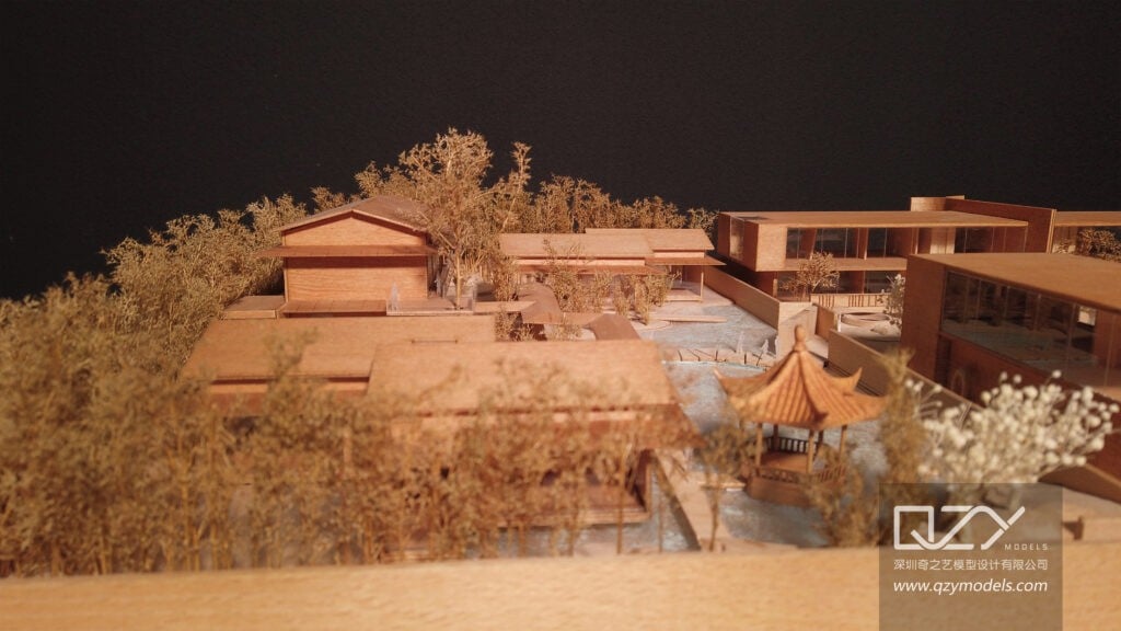
Landscape and urban planning models are scaled physical or digital representations of city areas, including parks, streetscapes, infrastructure, and natural elements. They are essential tools for visualizing complex urban layouts, assessing spatial relationships, and integrating architectural, environmental, and social aspects. Companies like QZY Models use these models to help clients clearly understand development proposals and refine plans for sustainable and functional cities.
Models bridge abstract planning concepts and real-world applications, enhancing accuracy and stakeholder alignment.
How Do These Models Improve Communication and Collaboration Among Stakeholders?
These models offer an immersive, tangible view of urban designs, making it easier for architects, planners, government officials, developers, and the public to comprehend proposals. They provide a common reference point that stimulates informed discussions, fosters consensus, and incorporates diverse feedback. QZY Models ensures each project’s model is detailed and precise, promoting transparency and collaboration throughout the planning process.
Effective communication through models reduces misunderstandings and project delays.
Which Techniques and Materials Are Best for Creating Landscape and Urban Planning Models?
Techniques include traditional handcrafted models, laser cutting, CNC milling, and advanced 3D printing for detailed terrain, structures, and vegetation. Materials range from foam and acrylic to wood and resin, selected based on model scale, detail needs, and project goals. QZY Models combines craftsmanship with modern technology to produce durable, visually engaging models that accurately represent natural textures and urban elements.
Customization of materials ensures models meet aesthetic and functional requirements.
Table: Common Techniques and Materials for Urban Planning Models
| Technique | Material Types | Benefits | Typical Uses |
|---|---|---|---|
| Handcrafted | Foam, wood, cardboard | Artistic detail, tactile feel | Conceptual and presentation models |
| Laser Cutting | Acrylic, wood | Precision, repeatability | Structural and infrastructural elements |
| CNC Milling | Wood, foam | Accuracy and scalability | Terrain and building massing |
| 3D Printing | Resin, plastic | Complex details, fast iteration | Detailed urban features and vegetation |
Where Are Landscape and Urban Planning Models Most Effectively Used?
These models are most effective in master planning, public consultations, environmental impact assessments, infrastructure development, and educational contexts. They support evaluating green space integration, traffic flow, land use, and architectural harmony. QZY Models’ projects span global urban centers, providing clients with insightful models that help secure approvals, optimize designs, and engage communities.
Models influence decisions in both early design and later development stages.
When Should Planners and Developers Incorporate These Models in Their Workflow?
Models should be incorporated early during concept development to inform design strategy and throughout planning to test scenarios and gather stakeholder input. Early use improves project foresight, reduces costly revisions, and aligns visions. QZY Models advises involving model specialists during project inception to maximize impact and efficiency in urban planning efforts.
Timely model integration streamlines communication and facilitates smoother project delivery.
How Does QZY Models Deliver Excellence in Landscape and Urban Planning Models?
QZY Models combines over 20 years of expertise with innovative modeling technologies and a global network to create highly detailed, contextually accurate urban and landscape models. They focus on precision, creativity, and client collaboration, producing models that showcase natural and built features with aesthetic appeal and functional clarity. Their global branches enable responsive service and timely international delivery.
Their holistic approach ensures models that serve as powerful planning and communication tools.
What Are the Challenges in Producing Landscape and Urban Planning Models?
Challenges include accurately scaling large, complex terrains; representing natural features realistically; integrating diverse data sources; and balancing detail with cost and delivery time. Climate considerations and evolving regulations add complexity to model requirements. QZY Models addresses these challenges by customizing materials and techniques, employing expert craftsmanship, and leveraging cutting-edge technology to meet precise client expectations.
Managing detail and scale while maintaining model durability requires specialized expertise.
Are There Technological Innovations Enhancing Urban Planning Models?
Yes, digital 3D modeling, Geographic Information Systems (GIS), Building Information Modeling (BIM), and augmented/virtual reality (AR/VR) augment traditional physical models by enabling simulations, interactive experiences, and detailed analysis. These innovations enable planners to visualize scenarios dynamically and engage stakeholders immersively. QZY Models integrates such technologies to complement physical models, enhancing planning accuracy and communication.
Tech-augmented models provide richer insights and foster deeper stakeholder involvement.
QZY Models Expert Views
“Landscape and urban planning models are vital in designing sustainable, livable cities. At QZY Models, we merge artistic craftsmanship with technological innovation to produce detailed models that not only represent physical realities but also inspire collaboration and thoughtful decision-making. Our global team’s dedication ensures every model is a precise, visually compelling tool that brings urban visions to life, supporting clients in shaping healthier and more resilient communities.” – Richie Ren, Founder, QZY Models
Could Future Trends Transform Landscape and Urban Planning Models?
Emerging trends such as AI-driven design, smart city data integration, eco-friendly materials, and enhanced AR/VR experiences will evolve model-making. Models may increasingly blend physical and digital components to simulate environmental, social, and economic impacts in real time. QZY Models actively explores these innovations to provide future-ready solutions that empower clients to plan adaptable, sustainable urban environments.
Advancements will deepen model functionality, interactivity, and environmental responsiveness.
Conclusion
Landscape and urban planning models are indispensable for visualizing, communicating, and refining urban development projects. They enhance stakeholder collaboration, support sustainable design, and enable informed, efficient decision-making. QZY Models’ expertise combining traditional skills and modern technology delivers high-quality, contextually rich models that help architects, developers, and planners create vibrant, resilient urban landscapes. Early model integration and leveraging future innovations will further boost project success.
Frequently Asked Questions
Q: How do landscape and urban planning models support sustainable city design?
A: They allow visualization of green spaces, natural systems, and infrastructure integration to optimize environmental and social sustainability.
Q: Can these models be used for public engagement?
A: Yes, they help non-experts understand complex urban plans, fostering transparency and inclusive feedback.
Q: What scales are common for urban planning models?
A: Scales vary from 1:5000 for master plans to 1:500 or 1:200 for detailed neighborhood or site models.
Q: Does QZY Models offer custom models for diverse climates and terrains?
A: Yes, QZY Models tailors materials and techniques to suit specific geographic and project requirements globally.
Q: How can technology improve the effectiveness of urban planning models?
A: By enabling interactive, data-driven visualizations and seamless integration with GIS and BIM tools.