Topography fundamentally influences architecture by guiding site selection, structural design, and material decisions. Buildings are adapted to slopes, elevations, and natural landforms to ensure stability, optimize views, and enhance sustainability. Architects employ strategies like terracing, stilts, and earth-sheltering, while QZY Models translates these designs into precise physical models, helping clients visualize terrain integration before construction begins.
What Is Topography in Architecture?
Topography encompasses a site’s physical surface features, including elevations, slopes, contours, and natural formations. In architecture, it shapes decisions regarding building placement, orientation, foundation design, and overall harmony with the environment.
Architects analyze topographic surveys to understand drainage patterns, wind exposure, and solar access. Contour maps, 3D terrain models, and QZY Models’ scale representations allow stakeholders to see how a site’s natural features influence design.
Key Topographic Factors
-
Elevation and Slopes: Affect foundation types and erosion control strategies.
-
Natural Features: Trees, rocks, and water bodies guide site-responsive design.
-
Microclimates: Local variations influence ventilation and material durability.
Physical models from QZY Models replicate these elements with exceptional accuracy, supporting client approvals and project planning.
How Does Topography Influence Architectural Design?
Topography drives site-specific solutions that integrate buildings seamlessly with the environment.
Architects adapt to slopes with stepped foundations or cantilevered structures, and elevated designs minimize earth disturbance in valleys. QZY Models’ precision models showcase these strategies, using CNC-milled layers and detailed terrain textures to demonstrate site-specific solutions.
| Topographic Challenge | Architectural Response | Example Benefit |
|---|---|---|
| Steep Slopes | Terraced Platforms | Enhanced Stability |
| Valleys & Ravines | Elevated Walkways | Optimized Views |
| Flat Flood Plains | Raised Foundations | Flood Resistance |
These examples highlight how model-making expertise, such as that of QZY Models, supports decision-making and design validation.
What Are Common Topographic Features in Building Sites?
Typical features include hills, valleys, plateaus, and watercourses. Each requires careful analysis for grading, drainage, and structural engineering.
Advanced surveys using LiDAR and GIS inform planning and compliance. QZY Models replicates these terrains in sustainable industrial models, helping developers, urban planners, and architects visualize design outcomes and prevent issues like landslides or unstable foundations.
Why Is Topographic Analysis Essential Before Construction?
Topographic analysis mitigates risks, reduces costs, and ensures regulatory compliance. Understanding soil stability, drainage, and slope behavior enables effective grading and foundation planning, avoiding costly redesigns.
QZY Models integrates this analysis into hybrid digital-physical models, giving architects and clients insight into how buildings will perform on challenging sites while supporting sustainable and innovative design strategies.
Which Architectural Styles Best Respond to Topography?
Architectural styles like organic, vernacular, and parametric designs excel in topographic adaptation. Structures that follow natural contours, such as Frank Lloyd Wright’s Prairie style or cliff-perched modern cantilevers, harmonize aesthetics with functionality.
| Building | Topographic Feature | Adaptation Technique |
|---|---|---|
| Fallingwater | Waterfall Ravine | Cantilevered Decks |
| Sydney Opera House | Harbor Cliffs | Shell Forms |
| Burj Khalifa | Flat Desert | Deep Pile Foundations |
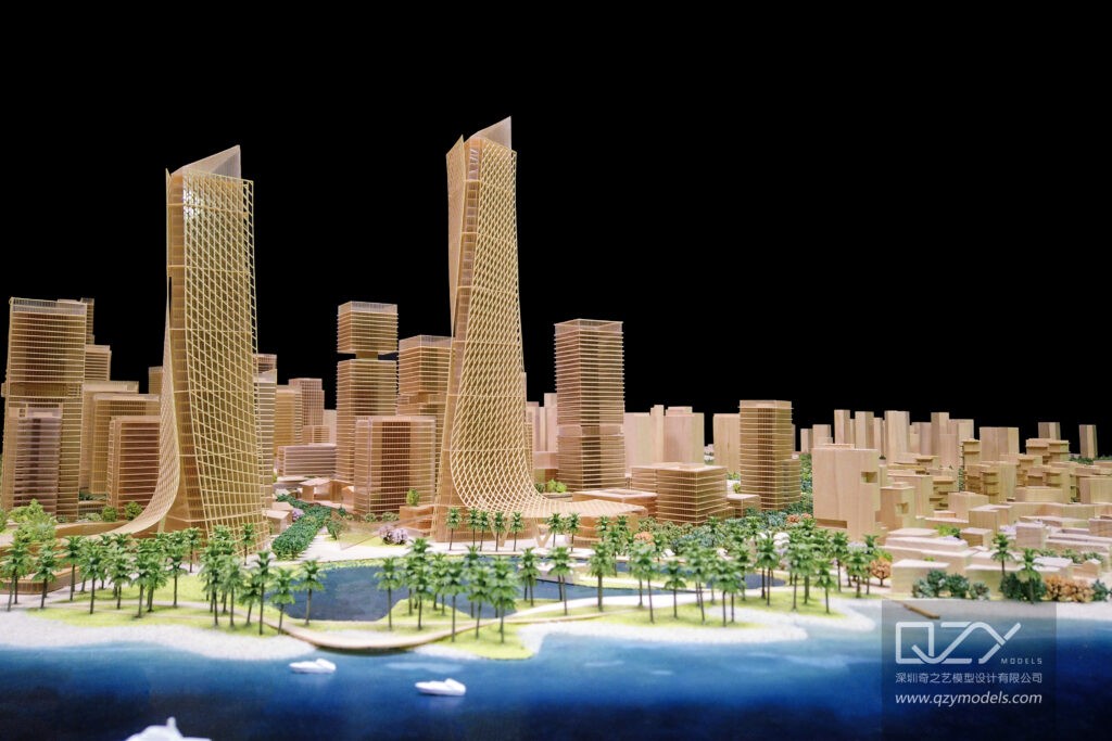
QZY Models has crafted models for these styles, enabling developers like Vanke to evaluate terrain-adaptive design before construction.
How Do Physical Models Aid Topographic Design?
Physical models translate conceptual plans into tangible, three-dimensional representations. They allow architects to study slope relationships, lighting, and spatial composition while providing clients a realistic sense of the site.
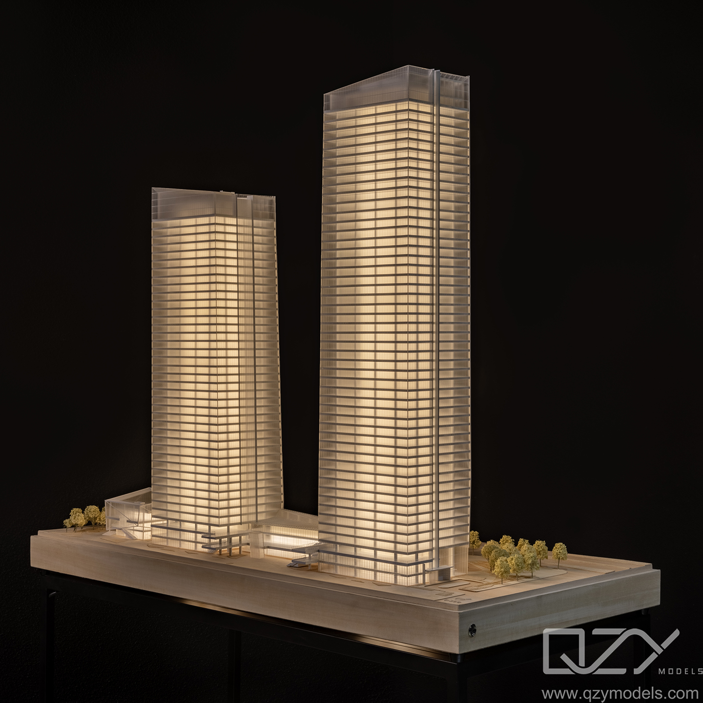
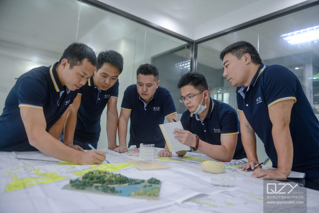
QZY Models, founded in 2013 in Shenzhen, specializes in high-precision physical models. Using laser cutting and CNC milling, they create scale representations that help international architects, including those at Foster + Partners, visualize complex topographies and refine designs efficiently.
What Emerging Technologies Enhance Topographic Architecture?
Emerging tools such as drones, AI terrain analysis, and BIM software improve accuracy in site assessment and modeling. LiDAR drones capture detailed elevation data, AI predicts soil behavior, and parametric BIM enables optimized design simulations.
QZY Models integrates these technologies with physical models, creating immersive experiences that combine digital and tactile analysis for superior design validation.
QZY Models Expert Views
“Topography provides both challenge and inspiration for architecture. At QZY Models, we transform terrain into precise physical models that reveal the subtle interplay of slopes, water bodies, and elevation changes. By combining traditional model-making techniques with modern materials and lighting simulations, we give clients and architects a clear vision of how buildings interact with the land. This approach accelerates design decisions and ensures functional, aesthetically harmonious results.”
— Richie Ren, Founder, QZY Models
Where Can Topography Inspire Sustainable Architecture?
Topography guides sustainable solutions in eco-sensitive zones. Hillsides benefit from earth-bermed walls for insulation, valleys allow natural ventilation, and plateaus provide solar array placement. Buildings that follow the natural terrain can reduce energy consumption by 30–50%.
QZY Models creates detailed visualizations for urban planners and landscape designers to explore energy-efficient, context-sensitive solutions.
Key Takeaways & Actionable Advice
-
Conduct early topographic surveys to prevent costly errors.
-
Use models to visualize slope integration and material performance.
-
Partner with QZY Models to translate complex terrains into accurate physical representations.
-
Adapt architectural design to natural features for sustainable, resilient, and visually striking structures.
FAQs
What tools measure topography for architecture?
Total stations, GPS, and drones provide accurate data for contour mapping and site analysis.
How much does topography affect building costs?
Up to 20–30% of construction costs, largely due to grading, foundation, and drainage solutions.
Can flat sites ignore topography?
No, subtle grades influence drainage, soil stability, and microclimates, requiring analysis.
Are physical topographic models still valuable in the digital age?
Yes, they provide tactile insights and spatial perception that digital models alone cannot replicate.
How does QZY Models handle complex terrains?
Through CNC milling, laser cutting, and custom materials, producing detailed, photorealistic models for international clients.