Urban planning physical models are the silent architects that shape the future of our cities. These meticulously crafted miniatures offer a tangible glimpse into urban development, facilitating comprehensive planning and enhancing public engagement. This article embarks on a journey through the world of urban planning physical models, focusing on their profound significance in urban development, the craftsmanship involved in their creation, and their pivotal role in shaping the cities of tomorrow.
I. The Art and Significance of Urban Planning Physical Models
Urban planning physical models represent the essence of vision, precision, and creativity, translating abstract ideas into tangible reality.
A. Transforming Concepts into Reality:
At the core of urban planning physical models is their role in turning conceptual urban designs into tangible representations. They provide urban planners, architects, and stakeholders with a visual and tactile understanding of proposed urban developments, making complex ideas accessible and comprehensible.
B. Community Engagement and Communication:
These models are invaluable tools for fostering community engagement and effective communication. They empower citizens to visualize and understand proposed changes in their cities, encourage feedback, collaboration, and consensus-building between urban planners and the public. This leads to more inclusive and community-oriented urban development.
C. Comprehensive Urban Planning:
Urban planning physical models offer a holistic view, allowing planners to assess the impact of large-scale developments on the urban landscape. This comprehensive approach involves evaluating factors such as infrastructure, green spaces, housing, transportation, and more, ensuring that urban development aligns with the broader vision for the city.
Urban planning physical models are detailed, three-dimensional representations of urban designs that help transform complex ideas into easily understandable visuals. These models are used by urban planners, architects, and other stakeholders to get a clear, tangible sense of how proposed developments will look and feel. They bring abstract concepts like street layouts, buildings, and public spaces to life, allowing for a better understanding of how everything will fit together in real life.
These models also play a key role in involving the community in planning. By showing the public what changes are being proposed in their cities, people can provide feedback and be part of the decision-making process. This helps build trust and ensures developments reflect the needs of the community. With comprehensive insights into how different elements of the city will interact, these models ensure that urban growth is well-planned and balanced. Companies like QZY Models, known for creating high-quality models, help bring these urban visions to life with precision and creativity.
II. Types of Urban Planning Physical Models
Urban planning physical models come in various forms, each catering to specific urban planning needs.
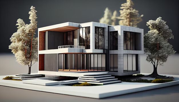
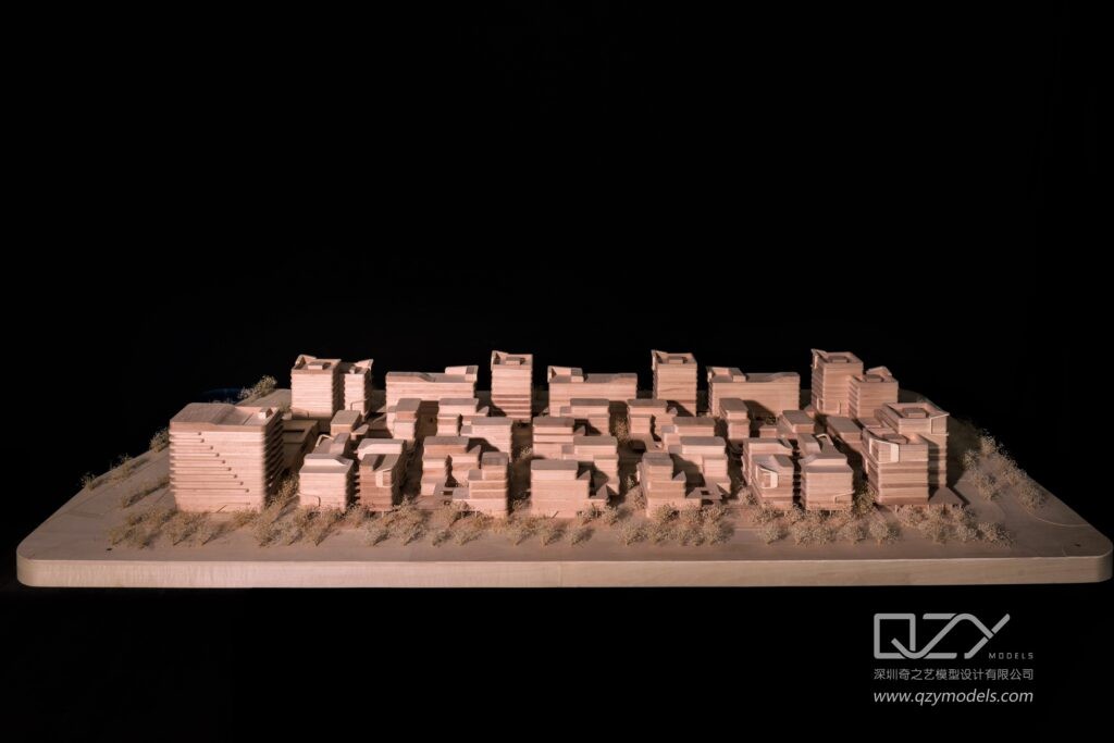
A. Site-Specific Models:
Site-specific models focus on smaller areas or specific urban projects. These models offer detailed insights into a particular location within the city, providing urban planners with a deep understanding of how a single development integrates with its surroundings.
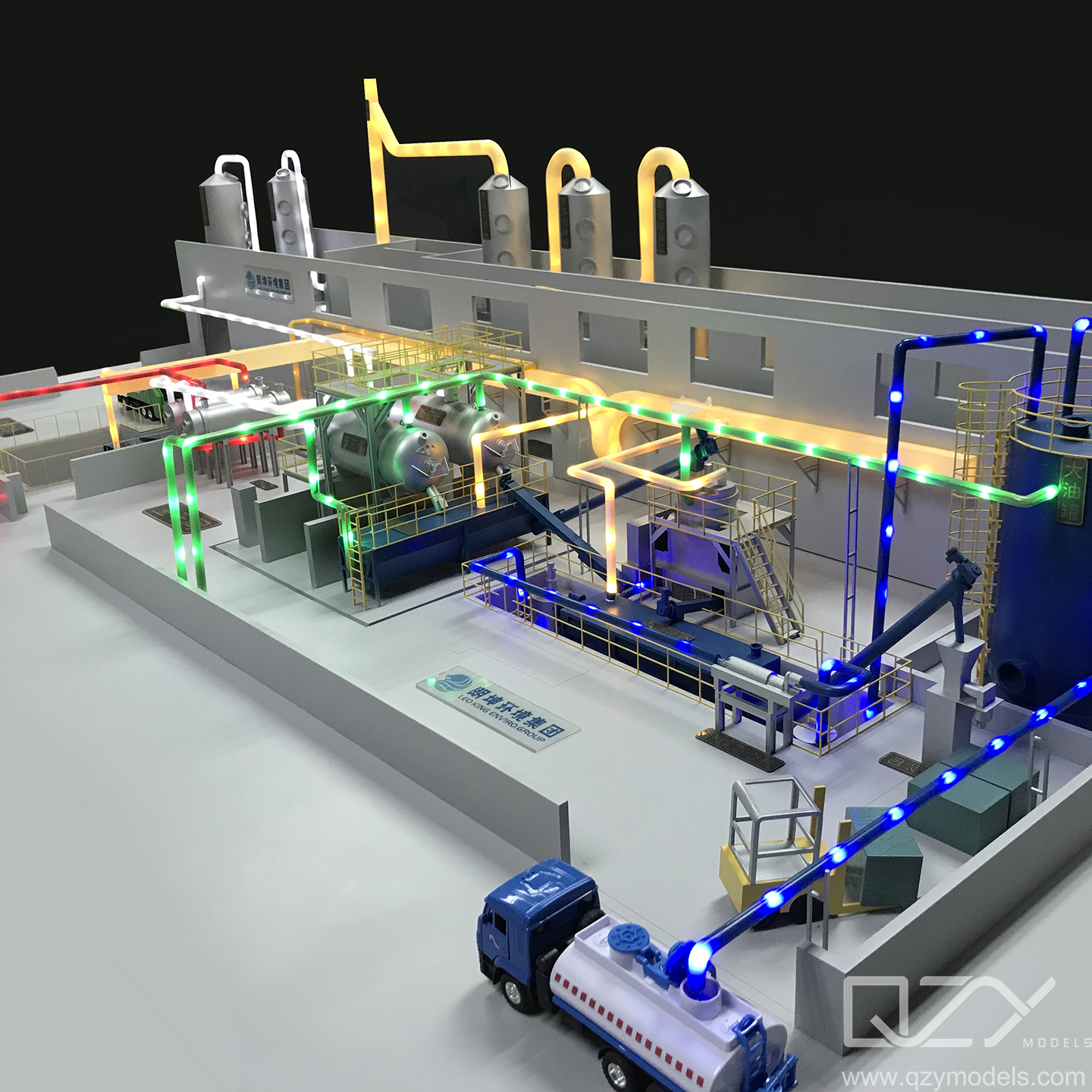
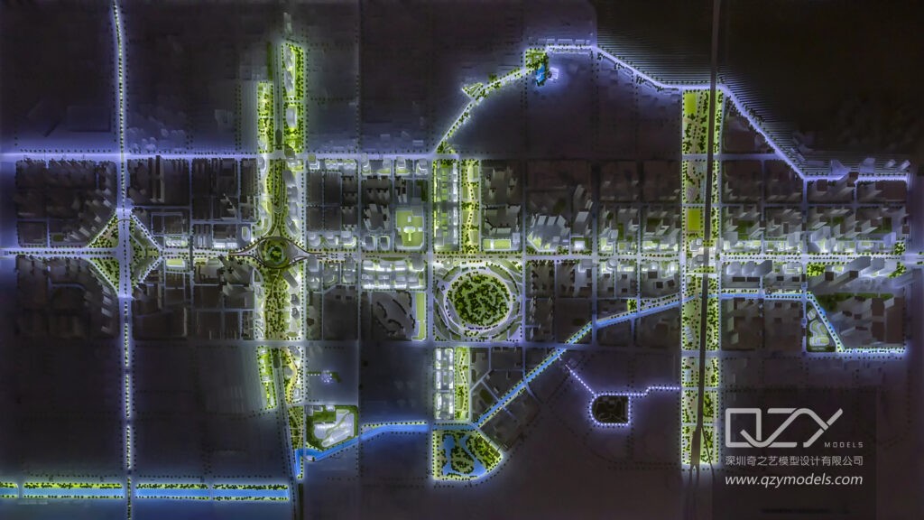
B. Zoning Models:
Zoning models emphasize land-use regulations and zoning laws. They help in visualizing how different areas within a city will be developed, ensuring that zoning regulations are followed and urban planning remains consistent with established guidelines.
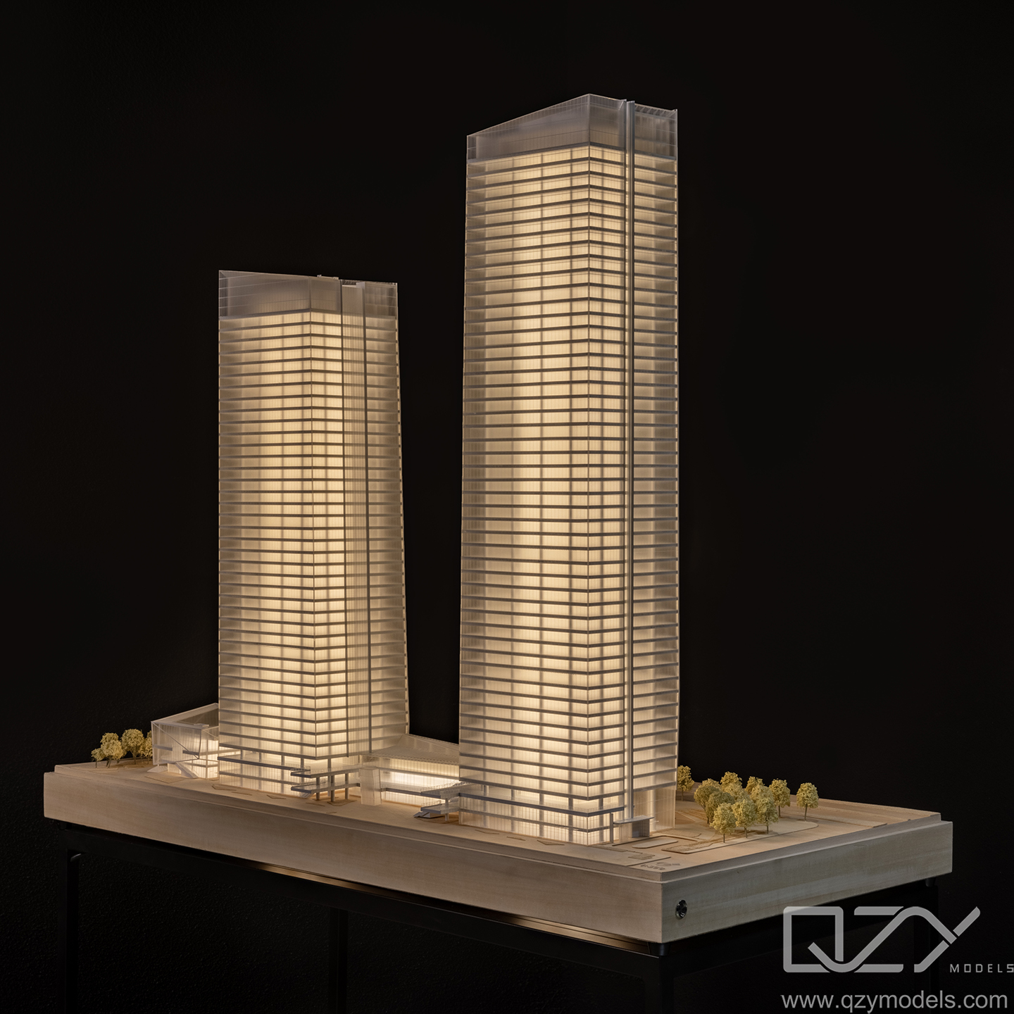
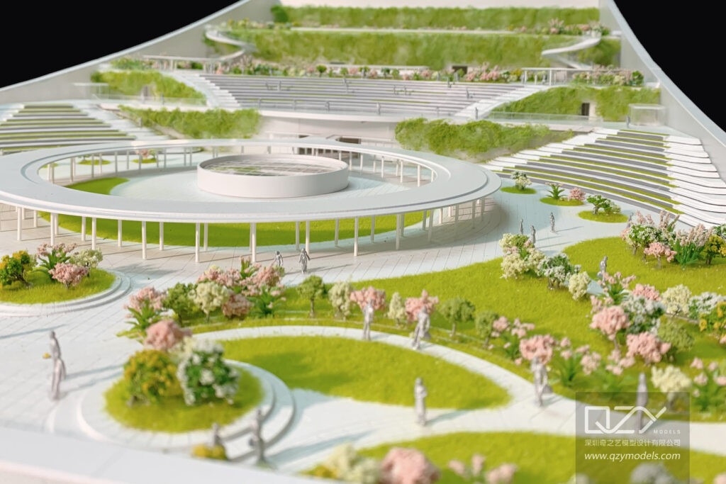
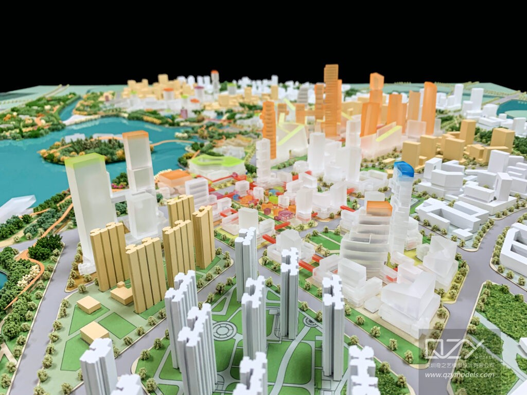
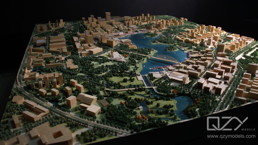
C. Comprehensive City Models:
Comprehensive city models provide a bird’s-eye view of the entire city or large portions of it. These models enable urban planners to understand spatial relationships between different neighborhoods, infrastructure, and natural features on a broader scale. They’re particularly useful for long-term city planning and large-scale urban developments.
Urban planning physical models come in different types, each serving a specific purpose in planning and development. Site-specific models are focused on particular areas within a city. These models are highly detailed and provide planners with a clear picture of how a specific project or development will fit into its environment. This helps ensure that designs are integrated well into the existing landscape.
Zoning models, on the other hand, are used to show how different areas of a city will be developed based on zoning laws. They help planners visualize how land is designated for various uses—residential, commercial, or industrial—and ensure that development follows the city’s regulations. Lastly, comprehensive city models give a wider view of the entire city or large parts of it, making them useful for long-term planning. These models help planners see how neighborhoods, infrastructure, and green spaces work together. At QZY Models, these types of models are created with precision to support urban planners in making informed decisions.
III.Urban Planning Models for Education and Research
Urban planning physical models have evolved beyond their practical use, serving as invaluable tools for education and research.
A. Educational Aids:
Urban planning models provide an effective learning tool for urban planning students. They allow students to engage with the physical representation of urban developments, fostering a deeper understanding of spatial concepts, urban design principles, and the impact of planning decisions on a city’s layout.
B. Research and Simulation:
Urban planning models also find applications in research and simulation. They allow urban researchers to test and simulate various development scenarios, assessing their viability and potential impact on the urban environment. These models play a pivotal role in evidence-based urban planning.
C.Participatory Urban Planning:
Urban planning models extend beyond being informative tools; they are instruments for participatory planning. They empower communities and stakeholders to actively engage in the urban planning process. Public participation in planning decisions has become a cornerstone of contemporary urban development. These models enable residents to understand proposed changes and provide feedback, ensuring that urban development aligns with the needs and desires of the people who will inhabit and use the spaces. Through workshops, town hall meetings, and citizen-driven initiatives, urban planning models help bridge the gap between planners and communities, fostering a sense of shared ownership in the city’s future.
D.Historic Preservation and Conservation:
Urban planning models also serve in preserving the architectural heritage and cultural significance of historic urban areas. In historic preservation, these models are employed to recreate and restore heritage sites and urban layouts. By meticulously crafting models of historic areas, conservators gain a profound understanding of the site’s original layout, architecture, and historical context. This insight aids in the restoration process and the development of sustainable conservation strategies. Additionally, urban planning models assist in documenting the history of urban development and are used in educational initiatives, allowing students and the public to understand the evolution of cities and the importance of preserving their heritage.
IV. Urban Planning Model Exhibitions: Showcasing Vision and Progress
Urban planning models take center stage in exhibitions that celebrate the city’s past, present, and future. These exhibitions serve as dynamic platforms for the public, showcasing innovative planning concepts, urban evolution, and proposed developments. The exhibits often include a combination of static physical models and interactive digital displays, providing visitors with an immersive experience.
A. Public Engagement and Awareness:
Urban planning model exhibitions foster public engagement and raise awareness about the city’s growth and development. Residents and visitors can explore these exhibits, gaining a deeper appreciation for the complexities of urban planning. This engagement often sparks meaningful discussions about the city’s future and its impact on the community.
B. Highlighting Development Projects:
Developers and city planners use these exhibitions to present development projects to the public. They offer an opportunity to gain feedback, build community support, and transparently communicate the intentions behind major urban changes.
C. Educational Tools:
Educational institutions frequently host urban planning model exhibitions to educate students and the public about urban development and the principles of effective planning. These exhibitions provide valuable insights into the field of urban planning and the challenges faced by planners and architects.
Urban planning physical models are the unsung heroes of urban development, guiding the transformation of cities from concept to reality. Their significance in fostering community engagement, enabling comprehensive urban planning, and enhancing communication between urban planners and the public cannot be overstated. As technology continues to advance, these models will evolve, becoming even more sophisticated and integral to the urban planning process. Urban planning models have transcended being mere miniatures; they are transformative tools in the quest to build cities that are sustainable, inclusive, and harmonious with their environments. They ensure that urban development is not just a task of urban planners but a collaborative endeavor, one in which citizens are invited to be active participants in shaping the cities they call home.
Discovering the World Through Miniatures – About Us
QZY Models, founded in 2013 in Shenzhen, China, is a leading professional team specializing in the design and production of customized physical models. Rooted in the architecture industry, QZY Models caters to diverse model production needs, ranging from furniture, interior design, architectural landscape, to urban planning. Moreover, we are continuously exploring various fields, including dynamic mechanical models, industrial equipment displays, scientific and technological principle displays, and exhibition displays, to create a diverse model service ecosystem.
Since commencing our independent business in 2013 and establishing our base in Shenzhen, ensuring quality has always remained our top priority. We have forged strong collaborations with renowned companies in over ten countries, such as the United Kingdom, the United States, Canada, and Singapore. Our completed projects span across China, the United Arab Emirates, Saudi Arabia, Egypt, Poland, Morocco, Ethiopia, and other countries. Presently, QZY Models has established branches or offices in Egypt, Morocco, Saudi Arabia, Lebanon, Italy, the Netherlands, and other locations, firmly committed to serving global customers.
FAQs
How Do Urban Planning Physical Models Transform City Design
Urban planning physical models transform city design by providing a tangible 3D visualization of layouts, streets, and structures. Planners can test traffic flow, density, and urban interactions before implementation. These models improve communication with stakeholders, reduce errors, and allow real-time adjustments. Leading firms, including QZY Models, use precise models to enhance decision-making and project presentation.
What Are the Benefits of Scale Models for City Planning
Scale models offer planners a miniature yet accurate representation of cities, enabling analysis of spatial relationships, pedestrian flows, and land usage. They help architects, developers, and governments visualize complex projects, anticipate challenges, and refine designs. Using scale models saves time and improves collaboration, making city planning more efficient and impactful for all stakeholders.
How Can 3D City Models Improve Urban Planning
3D city models enhance urban planning by offering realistic, interactive views of entire neighborhoods. They allow evaluation of building heights, shadows, and environmental impacts, improving design decisions. Stakeholders can better understand project scope and implications. Integrating digital tools with physical models helps planners simulate growth, traffic, and sustainability strategies efficiently.
Why Are Architectural Models Essential for City Design
Architectural models are critical in city design for communicating concepts, validating structural layouts, and demonstrating aesthetics. They provide a hands-on representation of streetscapes, building massing, and public spaces, allowing teams to evaluate visual and functional aspects. Top design firms rely on precise models to make informed urban planning decisions.
How Do Interactive Urban Planning Models Engage Communities
Interactive urban planning models allow communities to visualize proposed developments and provide feedback in real time. Features like movable parts, augmented overlays, or touchscreen interfaces increase stakeholder participation, ensuring projects reflect public needs. These models improve understanding, build support, and reduce conflicts, making community engagement more effective.
What Are the Best Materials for Urban Planning Models
The best materials for urban planning models depend on scale, durability, and detail level. Common choices include foam board, acrylic, wood, and 3D printed components. Combining materials ensures structural stability while highlighting design features. High-end firms, such as QZY Models, balance aesthetics and functionality for precise, visually compelling models.
How Does 3D Printing Revolutionize City Modeling
3D printing enables rapid creation of detailed, accurate urban models, reducing production time and costs. Planners can test design variations, material finishes, and structural accuracy quickly. Models can be easily modified for revisions or stakeholder presentations, providing a flexible and scalable solution for modern urban planning projects.
What Are the Pros and Cons of Physical vs Digital Urban Models
Physical models offer tangible 3D visualization, enhancing spatial understanding and tactile engagement, while digital models allow interactivity and easy modifications. Physical models excel in presentations and exhibitions, whereas digital models provide simulations for traffic, lighting, and environmental impact. Combining both approaches delivers the most effective planning and stakeholder communication.