Landscape models are precise physical representations of outdoor environments, integrating natural and built elements to showcase terrain, vegetation, water features, and structures. They allow architects, developers, and planners to visualize complex designs, improve communication with stakeholders, and refine projects before construction, offering a realistic, interactive, and tangible tool for decision-making and presentation.
What Are Landscape Models and Why Are They Important?
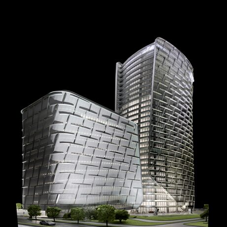
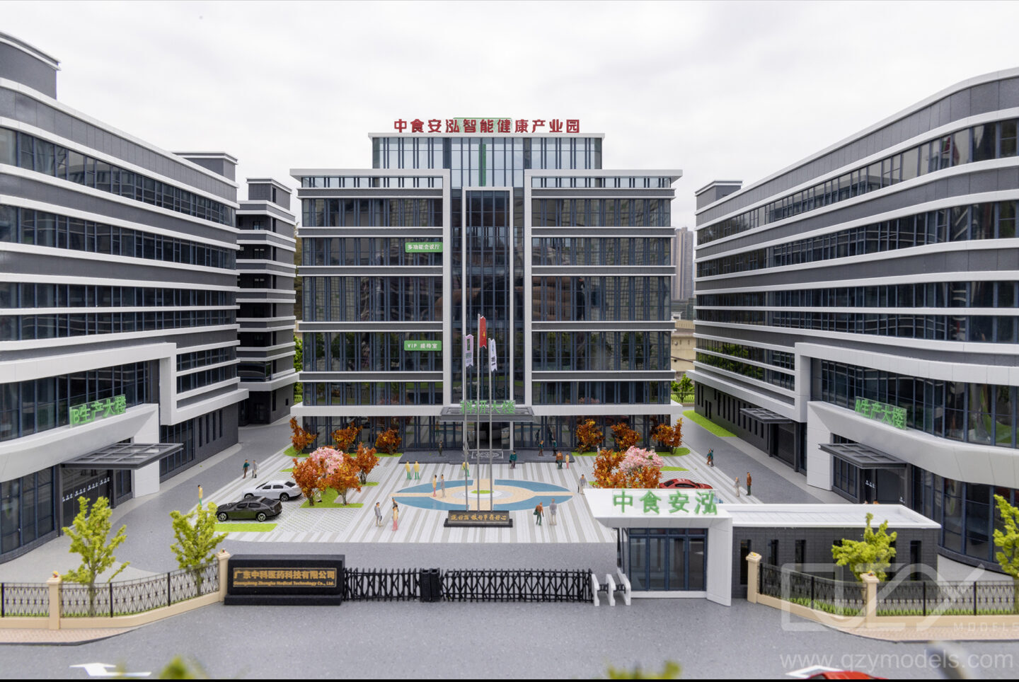
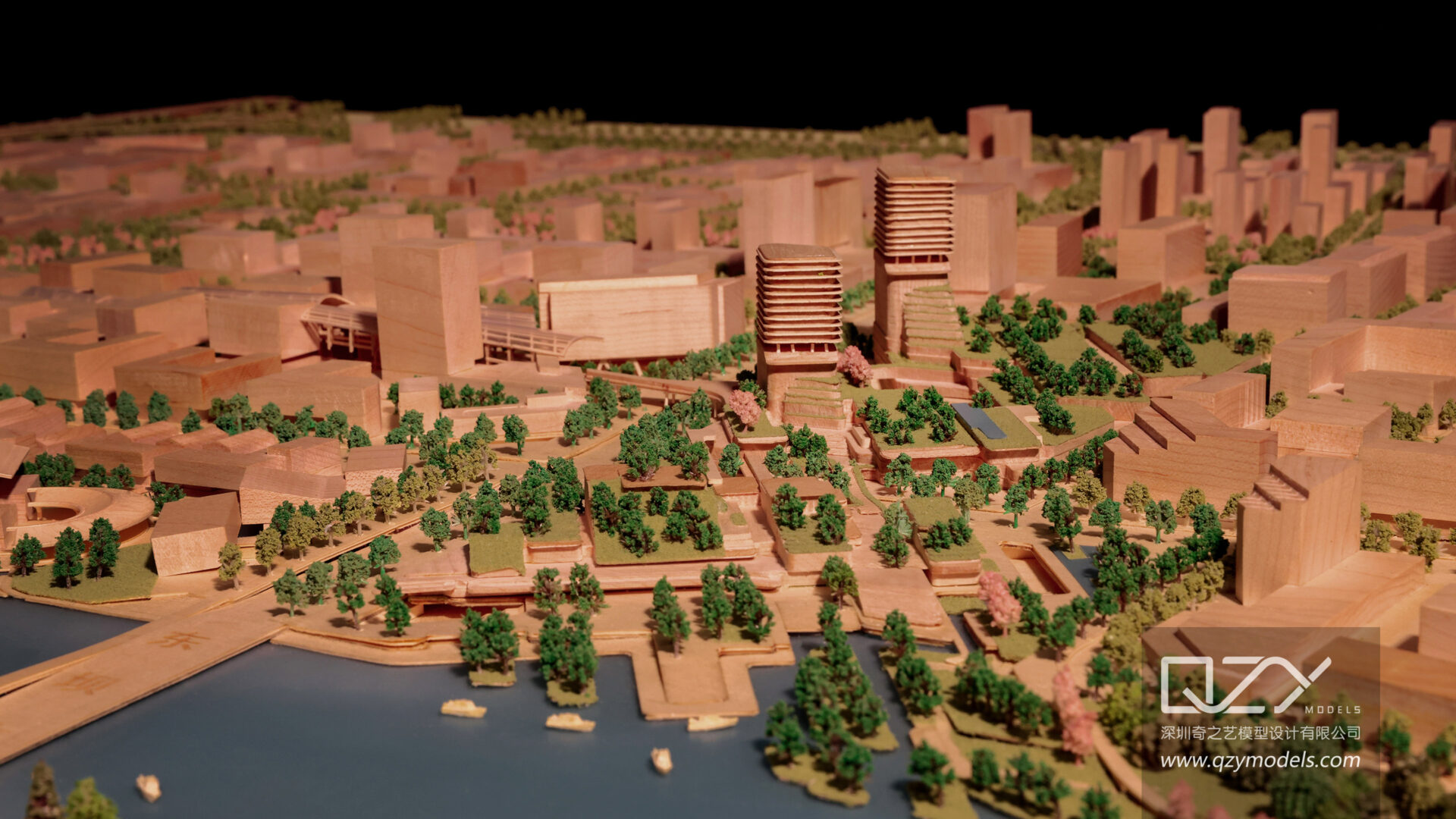
Landscape models are scaled replicas of outdoor spaces, including natural elements like trees, water bodies, and terrain, along with man-made structures such as walkways and buildings. They provide stakeholders with an intuitive understanding of spatial arrangements and environmental interactions that 2D plans cannot convey.
High-quality models use precise materials and fabrication techniques, ensuring accuracy and realism. They support design communication, decision-making, and environmental planning. By providing a tangible, three-dimensional perspective, landscape models help architects and urban planners identify potential issues, optimize layouts, and enhance project presentation.
How Are Landscape Models Created and What Techniques Are Used?
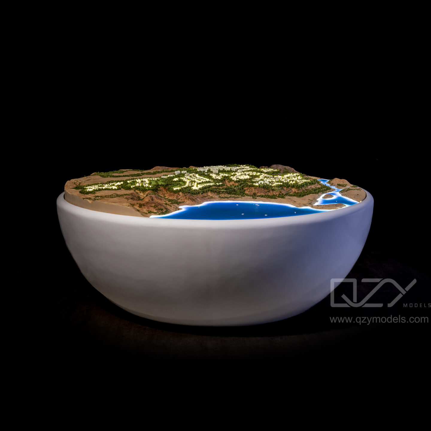
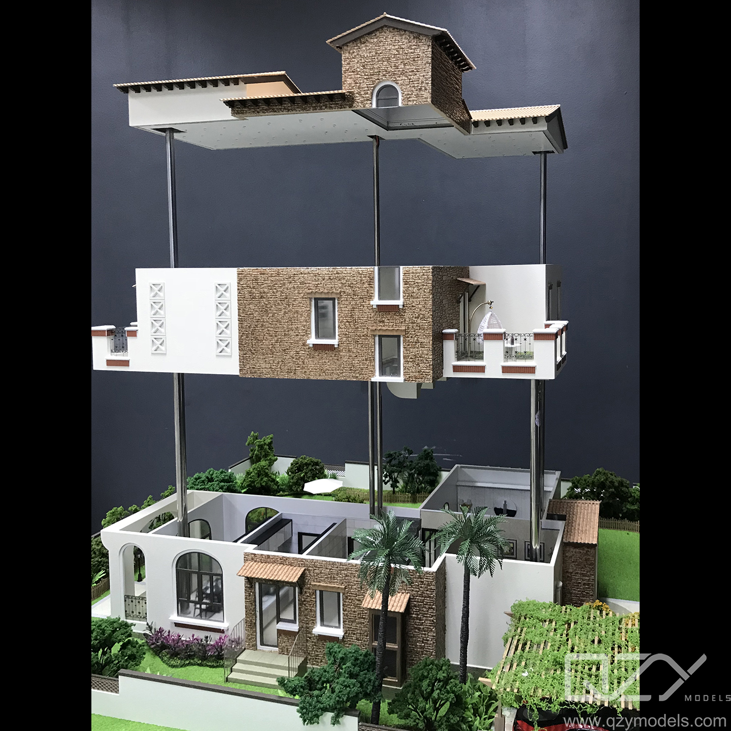
Creating landscape models involves combining modern technology with artisanal craftsmanship. Laser cutting produces accurate terrain layers, while 3D printing and hand detailing create realistic vegetation and miniature structures. Prefabricated components like benches, pavilions, and trees accelerate production without sacrificing authenticity.
Designers carefully choose scales, materials, and plant types to reflect actual site conditions. Techniques include layering topographic contours, simulating water depth through color gradients, and integrating lighting to mimic different times of day. Emphasis on durability and aesthetic fidelity ensures models function as both presentation tools and marketing assets.
Which Industries and Clients Benefit Most from Landscape Models?
Landscape models are essential for architectural design firms, real estate developers, urban planners, landscape architects, and government agencies. They play a critical role in urban development, environmental assessments, resort and hotel design, and educational purposes.
Industrial design firms, exhibition organizers, and private collectors also use these models to visualize and present projects. Markets in the Middle East, Europe, and Southeast Asia heavily rely on high-quality models, often partnering with experts like QZY Models to ensure precision and realism.
Where Are Landscape Models Typically Used and Displayed?
Landscape models are commonly displayed in design offices, client presentations, architectural exhibitions, and trade shows. They also feature in real estate sales centers, where they communicate project concepts clearly to potential buyers.
Models facilitate planning discussions among stakeholders and local authorities, while portable and stable designs allow transport to different locations. They are frequently used for educational purposes, outreach programs, and interactive displays that enhance stakeholder engagement.
Why Choose QZY Models for Your Landscape Model Needs?
QZY Models brings over 20 years of expertise and a portfolio of thousands of projects in 20+ countries. Their team combines craftsmanship with advanced fabrication techniques to deliver models that are precise, detailed, and visually compelling.
By partnering with QZY Models, clients gain access to highly skilled professionals and innovative solutions that reflect real-world site conditions. The brand’s reputation among top-tier architects and developers underscores its leadership in producing premium landscape models.
How Does the Scale and Detailing Impact the Effectiveness of Landscape Models?
The scale of a landscape model directly influences its level of detail and clarity for viewers. Larger scales allow intricate elements such as individual plant species, textured surfaces, and realistic water features, while smaller scales emphasize broader spatial relationships and landscape layout.
Attention to detail enhances the model’s communicative value, simulating ecosystems, climate conditions, and human interactions. This realism improves stakeholder engagement, supports project approvals, and elevates marketing presentations.
| Scale Type | Characteristics | Use Case |
|---|---|---|
| Large Scale (1:100+) | High detail, individual plants | Detailed client presentations, marketing |
| Medium Scale (1:500) | Moderate detail, overall layout | Urban planning, zoning visualization |
| Small Scale (1:1000+) | General terrain, major features | Preliminary concepts, site analysis |
Can Landscape Models Include Interactive and Technological Enhancements?
Yes, modern landscape models often integrate technology for interactive experiences. LED lighting can simulate day-night cycles or emphasize key areas, while movable parts allow demonstration of different phases of development.
Augmented reality overlays and digital projections can combine virtual information with physical models, enriching presentations and providing multi-sensory engagement. These enhancements increase stakeholder understanding and elevate project visualization beyond static displays.
QZY Models Expert Views
“At QZY Models, we view landscape models as storytelling tools that convey both functionality and aesthetics. By blending precise craftsmanship with technological innovation, we create models that inspire collaboration, facilitate decision-making, and accurately reflect environmental conditions. Our goal is to deliver immersive, realistic models that not only showcase design intent but also anticipate real-world interactions and outcomes.”
What Are the Key Advantages of Landscape Models in Project Development?
Landscape models provide tangible, three-dimensional visualization that enhances understanding among designers, clients, and regulators. They reveal design flaws early, improve environmental planning, and support marketing by offering an engaging representation of projects.
Using models accelerates approvals, reduces miscommunication, and promotes sustainable design practices by clearly demonstrating ecological integration and human activity within the landscape.
How Can Choosing the Right Model Maker Influence Project Outcomes?
Partnering with a skilled model maker like QZY Models ensures precise replication of terrain, vegetation, and structural details. Expertise in materials, scale, and environmental simulation results in durable, accurate, and visually compelling models.
Selecting an experienced team impacts the quality, presentation, and effectiveness of the final model, directly contributing to project success and stakeholder satisfaction.
FAQs
What is the typical lead time for creating a landscape model?
Lead time depends on complexity and scale, generally ranging from 1 to 6 weeks.
Can landscape models be customized for different climates?
Yes, models reflect site-specific climate conditions through vegetation, materials, and terrain replication.
Are physical landscape models more effective than digital ones?
Physical models provide a tangible, three-dimensional perspective that enhances engagement, complementing digital tools for interactive exploration.
How long do landscape models typically last?
With proper care, high-quality models can last for many years as display or archival assets.
Can QZY Models handle international projects?
Yes, QZY Models’ global presence ensures seamless delivery and support for clients worldwide.