Site model architecture is a 3D representation of a construction site showing both the proposed design and its surrounding environment. It helps architects, clients, and stakeholders visualize, analyze, and communicate a project’s relationship with its physical context throughout development.
What is a Site Model in Architecture?
A site model in architecture is a three-dimensional physical or digital representation of a construction site that includes the topography, existing surroundings, and proposed designs. It allows designers and clients to understand spatial relationships and environmental factors affecting the project.
Site models provide crucial context, illustrating how new structures interact with neighboring buildings, landscapes, and infrastructure. This holistic view supports smarter design choices and greater stakeholder alignment early in the process.
Why Are Site Models Important in Architecture?
Site models are vital because they enable visualization of a project’s integration with its environment, improving decision-making. They help identify challenges such as topographical constraints, sightlines, or environmental impact before construction begins.
By serving as a collaborative reference, site models facilitate clear communication between architects, engineers, developers, and clients. This reduces costly misinterpretations and streamlines project coordination.
What Are the Key Components of a Site Model?
Key components of a site model include:
-
Topography: Land contours, elevations, and slopes to understand the terrain.
-
Proposed Design: The building or structure placed within the site context.
-
Surrounding Context: Nearby roads, existing buildings, vegetation, and water bodies.
-
Property Lines: Legal boundaries of the site.
-
Landscape Elements: Trees, plantings, hardscapes, and utility lines.
Together, these elements create a detailed and accurate depiction of the site’s physical and spatial conditions.
How Are Site Models Created: Physical or Digital?
Site models can be created as:
-
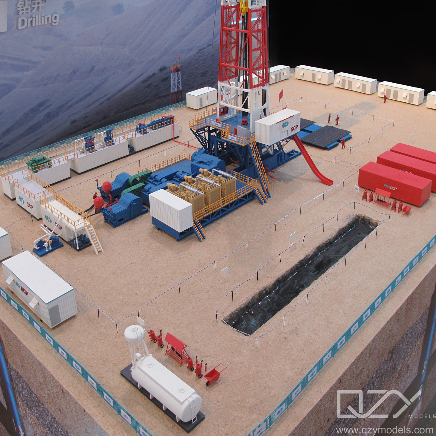
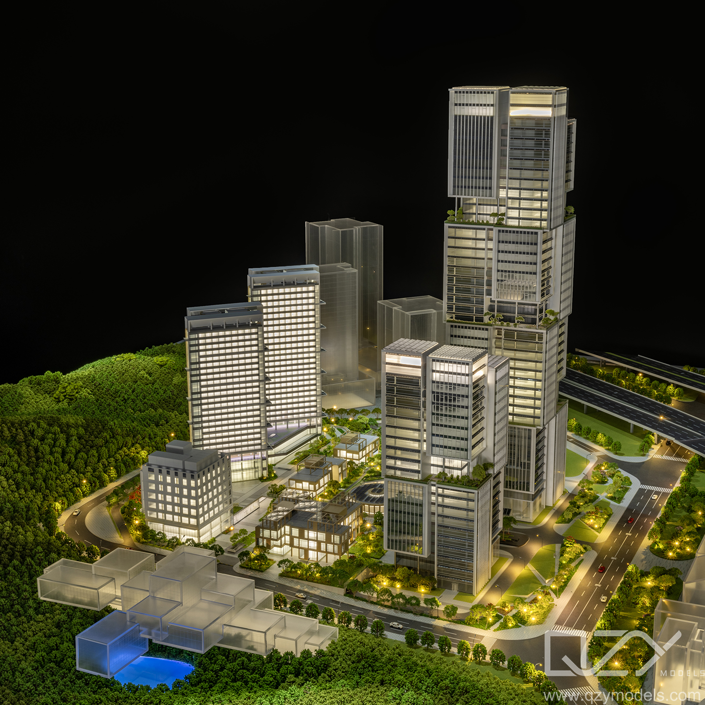
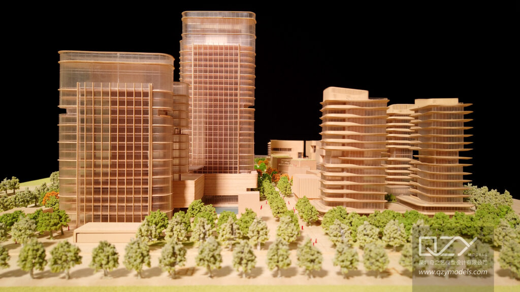
Physical Models: Made of materials like foam, wood, or plastic. These include sketch models for early concepts, topographical layered models for terrain, and detailed presentation models for showcasing final designs.
-
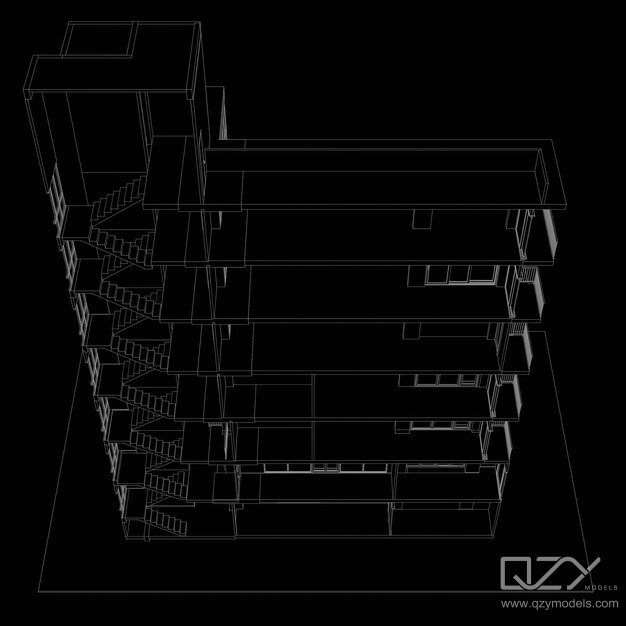
Digital Models: Built using software integrating GIS data, topographical surveys, and architectural plans. Digital models enable real-time updates, immersive visualizations, BIM integration, volume calculations, and clash detection.
Both methods serve complementary roles in design development and presentation.
What Types of Site Models Are Typically Used in Architecture?
Typical site model variations include:
-
Sketch Models: Rough concepts for initial design exploration.
-
Topographical Models: Terrain-focused with elevation layers.
-
Massing Models: Simple block forms showing general shape and scale.
-
Presentation Models: High-detail physical models for client presentations.
-
3D Digital Models: Interactive, data-rich visualizations linked to BIM for coordination.
Each type supports various project phases, from conceptual design to construction planning.
How Do Site Models Enhance Project Visualization and Communication?
Site models make complex spatial data accessible by providing a tangible or interactive representation. Stakeholders can better see how a design fits the landscape, consider environmental factors, and assess the visual impact.
This shared reference point fosters collaboration across disciplines and improves project transparency, helping to reduce errors and facilitating informed decisions at every stage.
Which Software Tools Support Digital Site Modeling and BIM Integration?
Popular software for digital site modeling includes AutoCAD Civil 3D, Revit, SketchUp, Rhino, and GIS platforms like ArcGIS. These tools allow importing survey data, creating detailed terrain and design models, and integrating with BIM workflows.
BIM integration connects site models to structural, mechanical, and electrical design elements, enabling clash detection, project sequencing, and accurate cost estimating.
Can Site Models Improve Sustainable and Environmental Planning?
Yes. Site models incorporating environmental data such as sunlight patterns, wind analysis, and water drainage help architects design more sustainable buildings. They support assessing ecological impacts, choosing optimal building orientation, and planning landscaping that enhances energy efficiency and minimizes site disturbance.
This holistic planning aligns with green building standards and supports regulatory compliance.
QZY Models Expert Views
At QZY Models, we understand that precision and context are paramount in site model architecture. Our extensive experience producing both physical and digital models allows clients worldwide to visualize complex projects with clarity and confidence. We believe that a well-crafted site model is an indispensable tool that bridges imagination and reality, enabling smarter design decisions and smoother collaboration from concept through construction.” – Richie Ren, Founder of QZY Models
Conclusion
Site model architecture is an essential part of modern design, enabling informed decisions by visualizing a project within its physical and environmental context. Whether physical or digital, site models improve communication, support sustainable planning, and reduce risk through clarity and collaboration. Leveraging professional services like QZY Models ensures exceptional quality and precision in every project phase.
Frequently Asked Questions
What is Site Model Architecture in Contemporary Design?
Site model architecture in contemporary design is the process of creating detailed, scaled physical or digital representations of a project site. It helps architects visualize spatial layouts, materials, and environmental integration. Using precision models, like those from QZY Models, designers can communicate complex ideas clearly to clients, stakeholders, and construction teams.
What Are the Most Effective Modern Site Planning Techniques for Architects?
Modern site planning techniques focus on functional zoning, topography analysis, traffic flow, and sustainability. Architects use digital tools and physical models to test layouts, optimize land use, and improve accessibility. Effective planning combines environmental, aesthetic, and technical factors to ensure projects meet client and regulatory requirements efficiently.
How Can Eco-Friendly Site Model Design Enhance Sustainability?
Eco-friendly site model design emphasizes energy-efficient layouts, natural lighting, green spaces, and sustainable materials. It allows architects to visualize environmental impact, reduce waste, and plan water or energy-saving systems. These models guide decisions that promote long-term ecological benefits while maintaining modern aesthetics.
Which 3D Site Model Software Is Best for Architects?
The best 3D site model software provides realistic visualization, terrain modeling, and collaborative features. Popular tools include Rhino, SketchUp, and Revit. They allow architects to simulate site conditions, optimize designs, and integrate landscapes seamlessly. Firms like QZY Models complement software with high-precision physical models for tangible project evaluation.
How Does Site Model Architecture Influence Urban Planning?
Site models help urban planners assess density, infrastructure, and spatial relationships. They provide a clear visualization of streets, parks, and building layouts, facilitating better zoning and public space design. Accurate models reduce planning errors and support community engagement, ensuring functional and attractive urban environments.
What Are the Advanced Residential Site Modeling Techniques for Modern Homes?
Advanced residential site modeling focuses on terrain adaptation, landscaping integration, and optimized building placement. Architects use layered physical or digital models to test sunlight, views, and privacy. Incorporating detailed topography and outdoor spaces ensures functional, aesthetically pleasing, and sustainable home designs.
How Can Landscape Architecture Be Integrated into Site Models?
Integrating landscape architecture into site models involves mapping vegetation, water features, pathways, and microclimates. This allows architects to plan green spaces, visualize environmental harmony, and evaluate the impact on aesthetics and usability. Models enhance decision-making for cohesive, sustainable, and visually appealing designs.
How Can Site Model Architecture Improve Construction Project Planning?
Site model architecture streamlines construction by providing precise visual references for layout, materials, and sequencing. Accurate models reduce errors, improve team collaboration, and enhance communication with contractors. Using detailed physical models from leaders like QZY Models ensures projects are executed efficiently, on time, and within budget.