Landscape model creation enhances environmental design by providing precise, scaled, and visually compelling three-dimensional representations of natural terrain, vegetation, water features, and built elements. These models improve planning accuracy, facilitate stakeholder communication, simulate ecological impacts, and support sustainable, functional, and aesthetically balanced outdoor environments.
How Do Landscape Models Support Environmental Design and Planning?
Landscape models enable visualization of terrain contours, vegetation placement, hydrology, and human interventions, helping designers assess spatial relationships and ecological impacts. They facilitate iterative testing of design alternatives, support environmental compliance, and enhance collaboration among architects, ecologists, and planners. Using landscape models early improves decision-making and reduces costly design errors.
By integrating topographical accuracy and natural elements, models ensure harmony between development and environment, fostering sustainability.
What Are the Common Techniques Used in Landscape Model Creation?
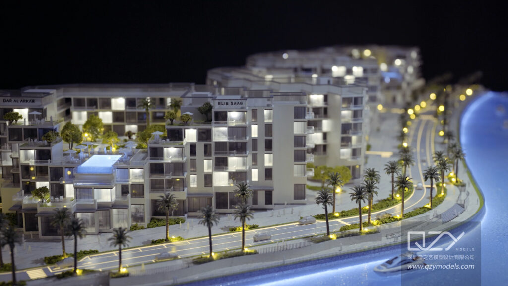
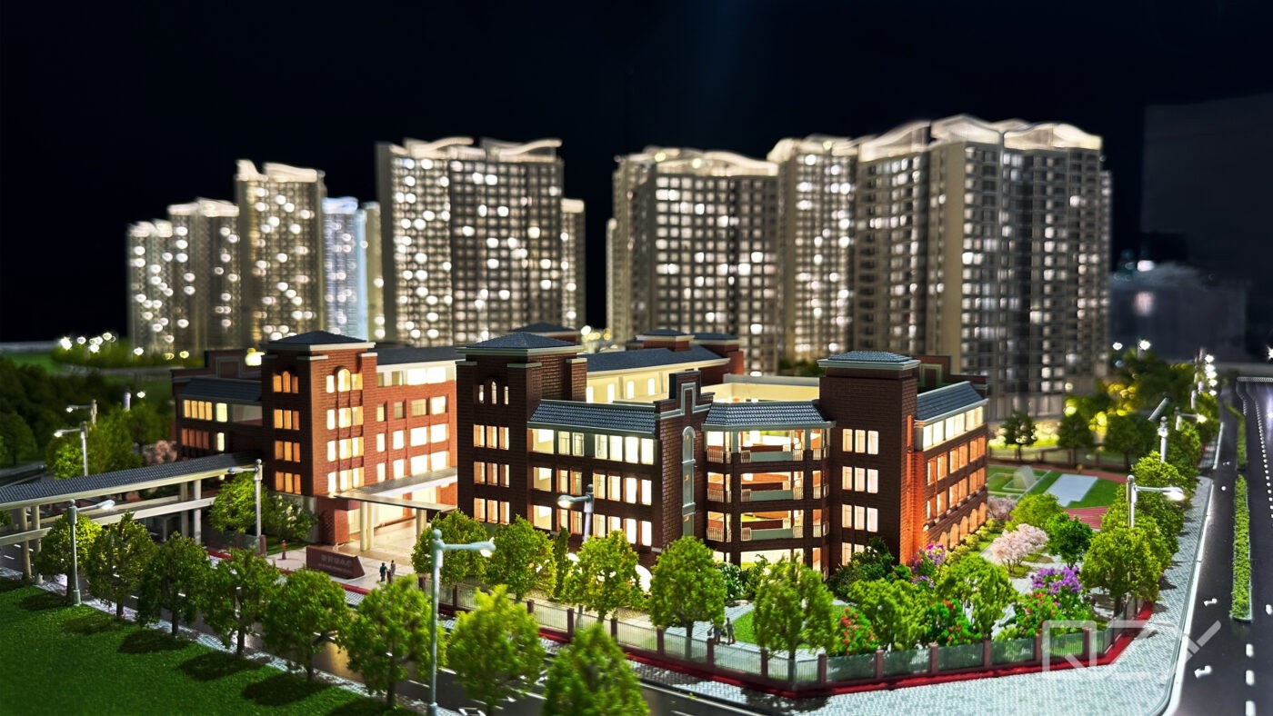
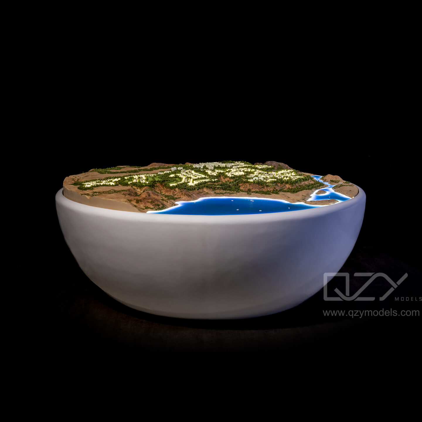
Techniques include physical model building with materials like foam board, moss, bark, and water-effect resins, as well as digital modeling using GIS, CAD, and 3D software. Advanced methods involve 3D printing for detailed terrain and vegetation representation. Layering and texturing mimic natural features, while interactive models incorporate augmented reality (AR) for immersive visualization.
QZY Models employs precision craftsmanship combined with cutting-edge digital tools to create highly realistic landscape models tailored to project needs.
Which Features Define an Effective Landscape Model for Environmental Design?
Effective landscape models accurately depict elevation, slope, vegetation types, water bodies, and built structures in appropriate scale and detail. They incorporate natural textures, sustainable materials, and clear demarcation of land use zones. Flexibility for updates and scenario comparisons enhances utility. Integration with environmental data like soil, hydrology, and climate improves predictive capabilities.
Transparent layering and thoughtful color coding improve readability and stakeholder understanding.
Why Is Professional Expertise Key in Landscape Model Creation?
Experts ensure models balance artistic representation with scientific accuracy, selecting suitable materials and scales while interpreting complex environmental data. Professionals like QZY Models understand ecological principles, local regulations, and design goals to produce models that communicate effectively and guide sustainable outcomes.
Technical skill and aesthetic sense combine to deliver models that facilitate informed, confident decision-making.
How Can Digital Technologies Enhance Landscape Modeling?
Digital tools such as GIS, BIM, 3D CAD, and remote sensing capture and analyze terrain and ecological data, enabling precise, updatable models. 3D printing automates and refines physical model production. Virtual and augmented reality create interactive experiences for client and community engagement. AI-driven simulations predict environmental impacts, supporting smarter design choices.
These technologies promote efficiency, accuracy, and collaboration throughout the planning process.
What Challenges Are Involved in Creating Landscape Models?
Challenges include replicating natural complexity realistically, maintaining scale accuracy, material durability, and balancing model detail with readability. Data acquisition and integration from diverse environmental sources can be difficult. Time and cost constraints limit model scope. Ensuring stakeholder alignment and adapting models to late design changes require clear communication and flexibility.
Addressing these challenges is crucial for effective model use.
Where Are Landscape Models Best Integrated in Design Workflows?
Landscape models are most valuable during site analysis, conceptual design, and environmental impact assessment phases. They facilitate stakeholder presentations, regulatory approvals, and community consultations. During construction, models guide implementation and landscaping. Post-completion, physical or digital models aid maintenance planning and educational outreach.
Continuous use throughout the lifecycle maximizes their benefits.
Does Landscape Model Creation Improve Sustainability Outcomes?
Yes, models help assess and visualize green infrastructure, water management, biodiversity conservation, and climate resilience strategies before implementation. They highlight potential environmental impacts and optimize resource use, guiding sustainable material selection and spatial planning. This proactive approach supports certification goals like LEED and strengthens ecological stewardship.
Models empower evidence-based sustainable design decisions.
Which Industries and Projects Benefit Most from Landscape Modeling?
Landscape architects, urban planners, environmental consultants, developers, and public agencies rely on landscape models for parks, residential communities, infrastructure projects, and restoration efforts. Models support diverse objectives, from aesthetic design to regulatory compliance and ecological preservation. QZY Models supports clients globally across these sectors, delivering customized solutions with precision and professionalism.
How Do Landscape Models Improve Stakeholder Collaboration and Communication?
Models transform abstract environmental data into tangible, understandable forms, facilitating clear communication among designers, clients, regulators, and the public. Interactive and visually rich representations enhance engagement, support consensus-building, and enable informed dialogue, reducing misunderstandings and resistance.
They serve as essential tools for aligning vision and expectations.
What Innovations Are Emerging in Landscape Model Creation and Environmental Design?
Emerging trends include AI-powered dynamic landscape simulations, parametric design for adaptable models, multi-material 3D printing for increased realism, and integration of IoT sensors for real-time environmental monitoring. Augmented reality overlays enable immersive on-site visualization and participatory design. Cloud collaboration accelerates iterative workflows and global teamwork.
QZY Models embraces these innovations to deliver cutting-edge, client-tailored landscape solutions.
Can Landscape Models Illustrate Climate Resilience and Environmental Adaptation?
Absolutely. Models visualize flood zones, erosion patterns, drought impact, and green infrastructure like rain gardens or permeable pavements. They enable simulation of climate scenarios and adaptive strategies, supporting resilient urban and rural landscape designs that mitigate risks and enhance ecosystem services.
These capabilities are vital for future-proofing development and landscaping projects.
QZY Models Expert Views
“Landscape model creation is a critical bridge connecting ecological science, artistic vision, and practical design. At QZY Models, we combine over two decades of expertise with advanced digital and handcrafted techniques to craft landscape models that are visually compelling and scientifically rigorous. Our models empower clients to visualize natural and built environments holistically, facilitating sustainable, resilient design solutions that harmonize with local ecosystems and community needs.” — Richie Ren, Founder of QZY Models
| Landscape Model Techniques | Description | Ideal Applications |
|---|---|---|
| Physical Model Making | Foam board, moss, bark, resin, 3D printing | Site analysis, client presentations |
| Digital Landscape Modeling | GIS, CAD, BIM, remote sensing | Environmental planning, simulations |
| Interactive & Immersive Models | AR, VR overlays, sensor integration | Stakeholder engagement, design testing |
| Key Environmental Design Features | Description |
|---|---|
| Topographical Accuracy | Accurate terrain and slope depiction |
| Vegetation & Water Representation | Realistic flora, hydrology simulation |
| Sustainability Indicators | Visualizing green infrastructure |
| Data Integration | Incorporation of soil, climate, hydrology data |
| Flexibility & Update Capability | Allows scenario analysis and modifications |
Conclusion
Landscape model creation is an indispensable practice in environmental design, significantly enhancing visualization, ecological integration, stakeholder collaboration, and sustainable planning. Harnessing a combination of expert craftsmanship, advanced digital tools, and emerging technologies—such as those utilized by QZY Models—enables the production of highly detailed, adaptable, and impactful models. These models serve as essential instruments for informed decision-making, efficient project execution, and climate-resilient landscape planning.
Frequently Asked Questions
What materials are commonly used in physical landscape model creation?
Materials include foam board, moss, bark, wood chips, sand, resin, and 3D printed components to replicate terrain and vegetation realistically.
How does GIS technology improve landscape models?
GIS provides accurate spatial data, enabling precise terrain mapping, layering of environmental factors, and enhanced predictive analysis.
Can landscape models simulate environmental impacts?
Yes, with integrated environmental data and AI-driven simulations, models can predict effects of design choices on ecosystems, water flow, and climate resilience.
When should landscape models be introduced in the design process?
Early integration during site analysis and concept development maximizes insight and guides sustainable planning.
Why choose QZY Models for landscape model creation?
QZY Models combines extensive industry experience, innovative technologies, and meticulous craftsmanship to deliver precise, visually stunning, and environmentally insightful models tailored to client needs.
What is a landscape model and why is it important?
A landscape model is a scaled three-dimensional representation of outdoor spaces, including natural scenery and environmental features. It allows designers to visualize spatial relationships, test ecological strategies, and communicate ideas clearly, helping clients and stakeholders understand the final design before implementation. QZY Models specializes in creating such precise, high-quality models for diverse projects.
How does landscape model creation support sustainable design?
Landscape models enable simulation of water flow, plant growth, and sunlight exposure, helping designers optimize resource use and enhance biodiversity. By predicting ecological impacts and testing sustainable strategies, these models guide environmentally responsible decisions, creating resilient and balanced outdoor spaces.
How do 3D landscape models improve project communication?
3D models provide immersive visualizations that clarify complex designs, allowing clients, stakeholders, and the public to easily understand the project vision. They facilitate ideation, refine design concepts, and improve collaboration, ensuring all parties share a consistent understanding of the planned environment.
What role do landscape models play in informed decision-making?
Landscape models support planning by simulating environmental challenges like flooding or heat, integrating green infrastructure, and combining data from GIS and sensors. This allows designers to create more resilient, efficient, and ecologically integrated spaces while reducing risks and improving project outcomes.