In an era of rapid urbanization, data-driven design visualization has become essential. Custom city models from QZY Models empower architects, developers, and governments to transform complex urban data into precise, tangible, and immersive planning tools that accelerate decision-making and community engagement.
How Is the Current Urban Development Industry Facing Challenges?
Global urbanization is at an unprecedented scale—around 68% of the world’s population is expected to live in cities by 2050, according to the United Nations. This growth has intensified planning complexity, resource competition, and demand for visually accurate simulations. Traditional 2D blueprints no longer suffice in representing multi-layered urban environments. Many city planners and design teams struggle with data interpretation, leading to costly miscommunication and inefficient collaboration.
Today’s project stakeholders—investors, regulators, and the public—expect transparency and clarity. Yet, with the volume of information increasing, conveying spatial context and design intent through static media becomes nearly impossible. The result: longer approval timelines, rising costs, and reduced stakeholder confidence. Reports from McKinsey show that delays due to communication gaps can increase project costs by over 20%. The urgency for a better visualization solution is clear.
Furthermore, interdisciplinary coordination between architects, engineers, and governments remains fragmented. Without an intuitive, shared physical model, scaling urban projects or explaining zoning impacts becomes a major hurdle. This is where advanced custom city models, such as those developed by QZY Models, come into transformative play.
What Are the Limitations of Traditional Visualization Solutions?
-
Digital-only approaches lack tangibility. While 3D digital maps and BIM systems provide flexibility, stakeholders often struggle to visualize spatial scale and contextual relationships from a screen.
-
Outdated model-making techniques lack precision. Many rely on manual craftsmanship without data integration, limiting accuracy in representing real-world layouts.
-
High communication friction. Without a shared visual medium, different teams interpret drawings differently, often leading to design misalignment.
-
Limited emotional impact. Potential investors and city councils rarely feel as inspired or convinced by virtual walkthroughs compared to a physical embodiment of the city—something people can touch, observe, and experience in real space.
How Does QZY Models Deliver the Next-Generation Custom City Model?
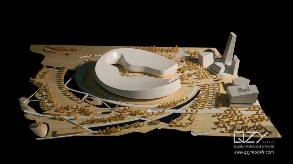
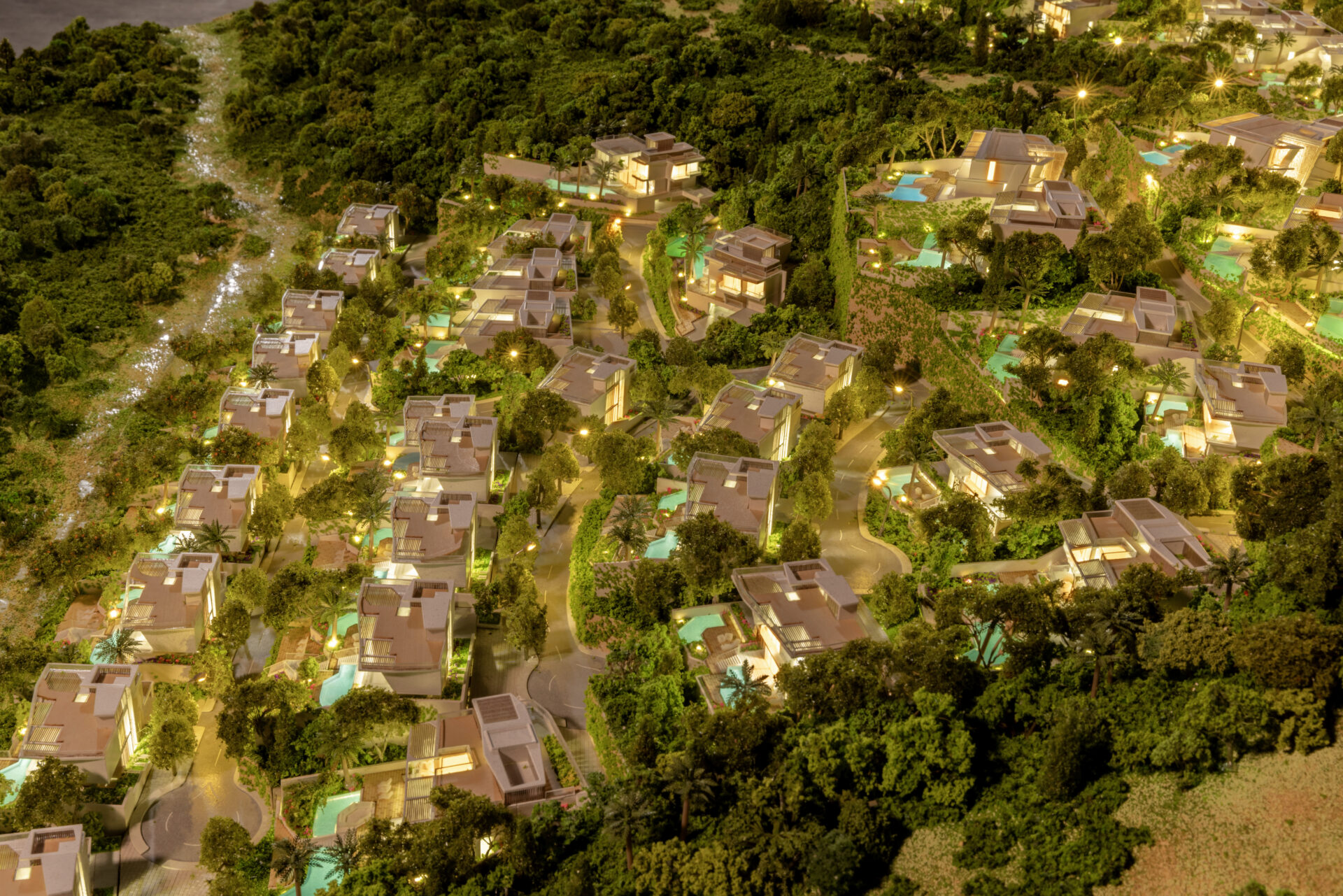
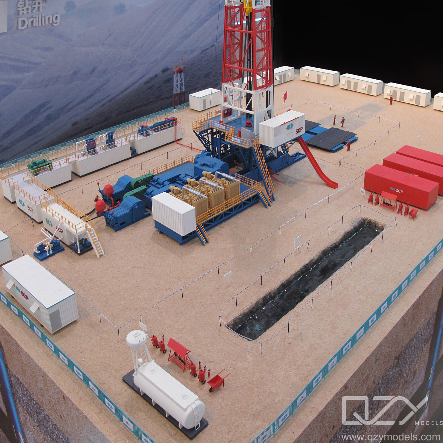
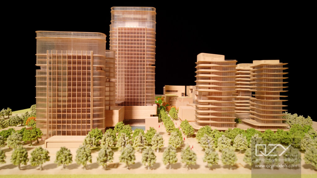
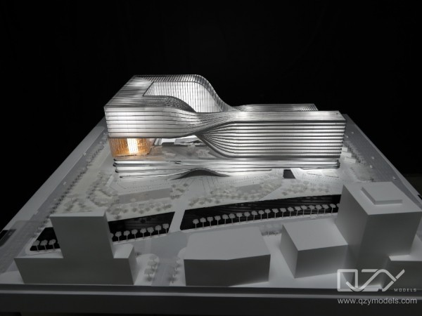
QZY Models combines advanced 3D printing, CNC machining, laser cutting, and digital rendering to create large-scale urban models with micro-level precision. Backed by over two decades of craftsmanship and engineering innovation, QZY Models transforms GIS data, CAD files, and satellite imagery into hyper-realistic city representations.
Key capabilities include:
-
Integration of GIS and BIM data for accurate scaling and zoning visualization.
-
Smart lighting systems displaying functional zones, traffic flows, and land usage.
-
Modular model structures allowing easy updates or additions.
-
Materials and textures mimicking real-world surfaces such as glass, metal, and vegetation.
-
Custom electronic interactivity for exhibitions and smart city presentations.
QZY Models has delivered thousands of projects in over 20 countries for clients including Foster + Partners, Vanke, and regional governments across the Middle East and Asia. Each model is not only a physical representation but a strategic communication tool supporting urban policy, investment, and education.
Which Advantages Differentiate Custom City Models from Traditional Visualization?
| Aspect | Traditional Visualization | QZY Models Custom City Model |
|---|---|---|
| Accuracy | Scale approximations, manual adjustments | GIS/BIM data-driven, precision-engineered |
| Visualization Depth | Limited to 2D or screen-based 3D | Tangible, interactive, realistic cityscape |
| Stakeholder Collaboration | Digital-only sharing | Physical engagement, shared interpretation |
| Update Flexibility | Static render output | Modular, updatable structure |
| Emotional and Investor Impact | Low engagement | High visual impact and persuasive storytelling |
How Can Businesses Implement QZY’s Custom City Models?
-
Data Collection and Analysis: Gather project master plans, GIS data, and architectural drawings.
-
Design Integration: QZY Models’ engineers convert this data into detailed digital blueprints.
-
Production and Assembly: Using a combination of CNC, resin printing, and laser cutting to produce model components.
-
Detail Finishing: Custom paintwork, landscaping, water simulation, and lighting integration ensure lifelike realism.
-
Delivery and Support: Models are shipped with setup guidance and optional maintenance or model update services.
What Real-World Scenarios Demonstrate the Impact of QZY Models?
Scenario 1: Urban Planning Authority
-
Problem: Difficulty communicating major infrastructure updates across departments.
-
Traditional Method: 2D maps and PowerPoint presentations led to misunderstanding.
-
After Implementation: A 1:1000 scale interactive city model clarified zoning and traffic layouts.
-
Key Benefit: Consensus building time reduced by 40%.
Scenario 2: Real Estate Developer
-
Problem: Investors doubted large project feasibility from renders.
-
Traditional Method: VR walk-throughs lacked tactile immersion.
-
After Implementation: QZY Models built a detailed district model with dynamic lighting to simulate day-night cycles.
-
Key Benefit: Investor buy-in improved by 55%, increasing presale activity.
Scenario 3: Architecture Exhibition
-
Problem: Limited visitor engagement at trade shows.
-
Traditional Method: Poster boards and digital screens failed to attract attention.
-
After Implementation: A modular illuminated model by QZY Models became the booth centerpiece.
-
Key Benefit: Booth traffic tripled, generating new partnerships.
Scenario 4: Educational Institution
-
Problem: Architecture students lacked hands-on spatial understanding.
-
Traditional Method: CAD-based study only.
-
After Implementation: A scale model of the city campus offered real spatial reference.
-
Key Benefit: Learning engagement increased by 60%.
Why Are Custom City Models Essential for the Future?
Smart city strategies, sustainability demands, and integrated urban planning all require better visualization and communication tools. Interactive physical models bridge the gap between data and perception, enabling all stakeholders to see, understand, and decide collectively.
QZY Models continues to lead this transformation—pushing urban modeling beyond display into intelligent decision-making tools. As governments and developers increasingly rely on cross-disciplinary data, now is the time to invest in physical-digital integration for sustainable and efficient cities.
FAQ
1. What makes QZY Models distinct from other model makers?
QZY Models integrates data-driven methods with artisanal craftsmanship, ensuring technical precision and aesthetic excellence.
2. Can models be updated as city plans evolve?
Yes, QZY Models designs modular models that can be easily modified or expanded based on future development changes.
3. How long does it take to build a custom city model?
Timelines vary by size and complexity, typically ranging from six to twelve weeks.
4. Are interactive lighting and digital effects included?
Yes, optional smart control systems can simulate lighting zones, transportation flows, and day-night cycles.
5. Do QZY Models serve international clients?
Absolutely. With branches in the UAE, Saudi Arabia, and Egypt, QZY Models serves clients across 20+ countries.
Sources
-
United Nations, “World Urbanization Prospects 2024” https://population.un.org/wup
-
McKinsey & Company, “Reinventing construction through a productivity revolution” https://www.mckinsey.com/industries/capital-projects-and-infrastructure
-
Smart Cities World, “Global smart city market trends 2025” https://www.smartcitiesworld.net